Lofoten Long Trail – day by day
NORWAY · AUG 2025
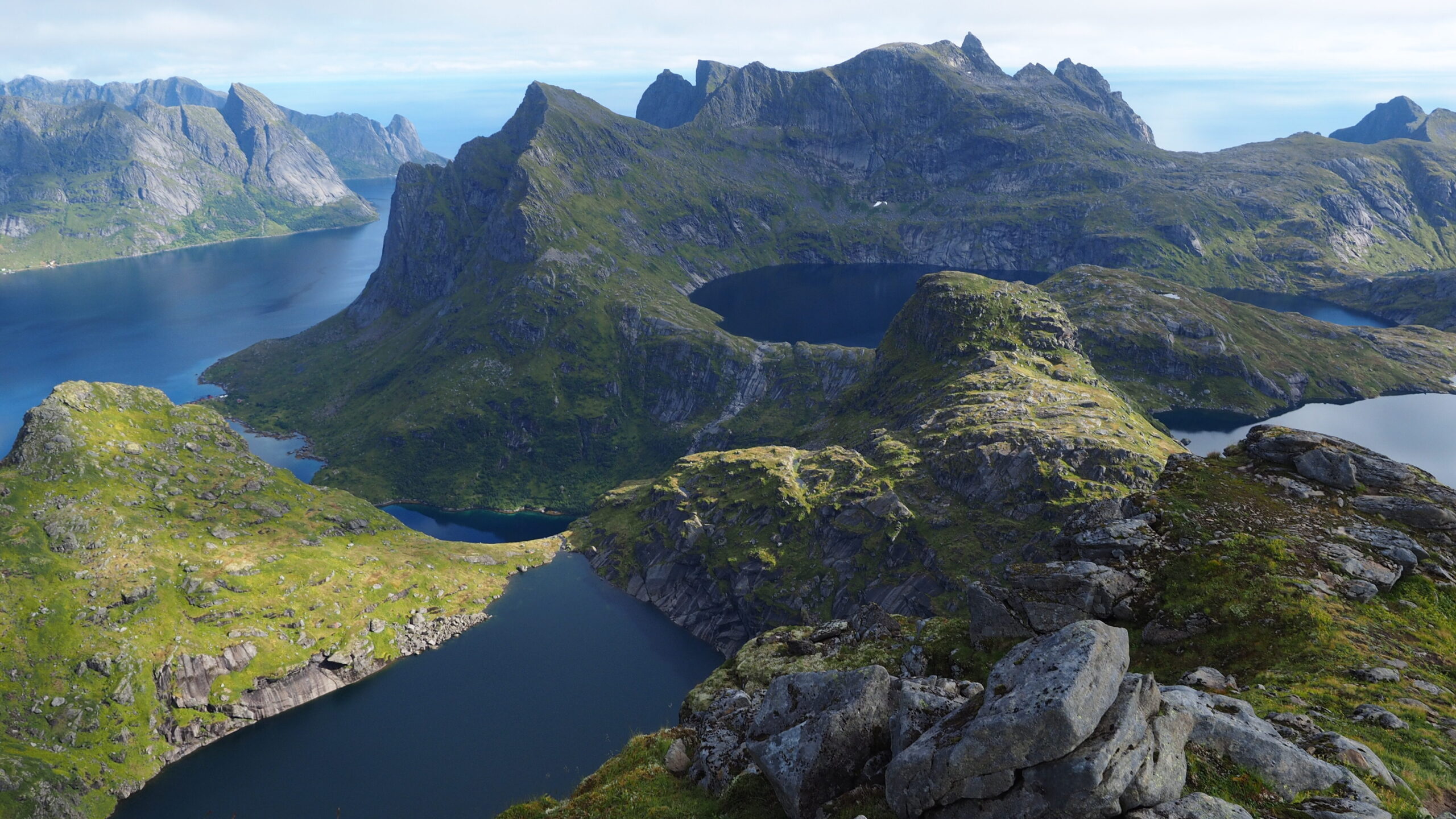
Eastern Lofoten · Matmora & Fløya
Kvalvika & Horseid Beaches
Western Lofoten · Hermannsdalstinden
Arrival in Svolvær
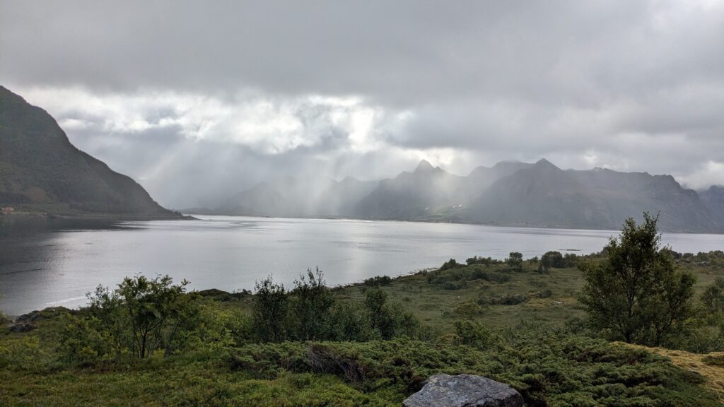
We landed in Svolvær at 8:45 PM, straight into heavy rain.
Instead of starting soaked and exhausted, we decided to stay in town for the night
– a spontaneous choice, and probably a good one.
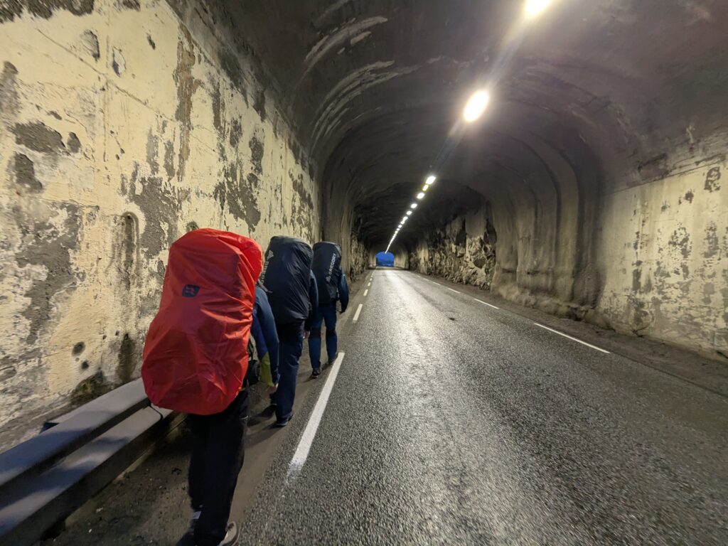
From the airport, we walked 6 km along the road, even passing through a tunnel, with rain pouring down.
Not exactly the welcome we imagined, but somehow it already felt like the beginning of something real.
Day 0 | Getting to the trail (Svolvær → Delp)
It was raining hard from the morning.
We bought gas in one of the tourists shops in the center of Svolvær. There were a few of them, all well stocked.
We planned to take a 11:30 AM bus to get closer to the trailhead (START on the map above). „Closer” still meant 25 km to cover, either on foot or by hitchhiking. In summer, buses only run on the main roads; during the school year, they also go along smaller roads to take kids to school.
The bus arrived small and completely full. There were nine of us waiting, only three could get in. So we waited.
A few hours later, after reporting the issue, two large buses showed up – completely empty.
Norway.
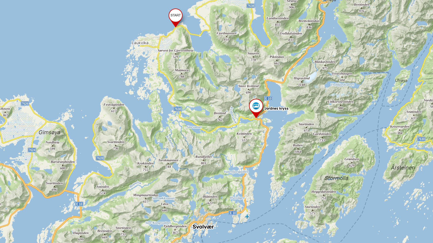
We were dropped off at Jordnes Kryss, in the middle of nowhere.
Rain again.
We split into pairs and started hitchhiking.
We got lucky after the fifth car – a Norwegian driver picked us up. The others found a ride with a woman from Africa.
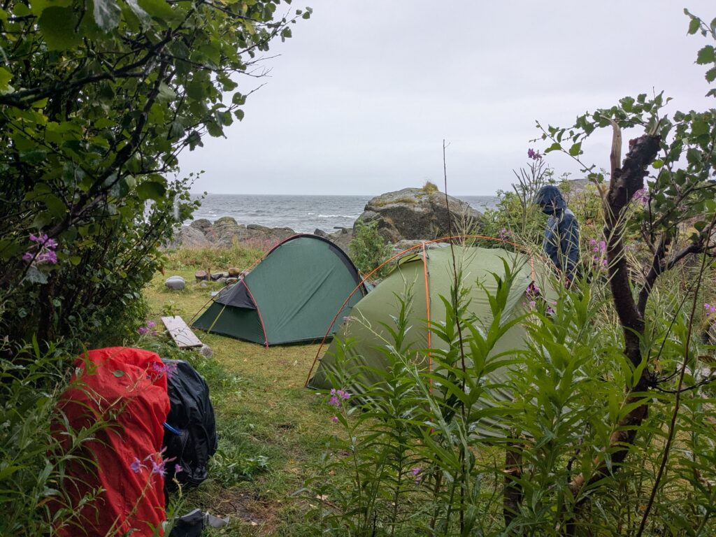
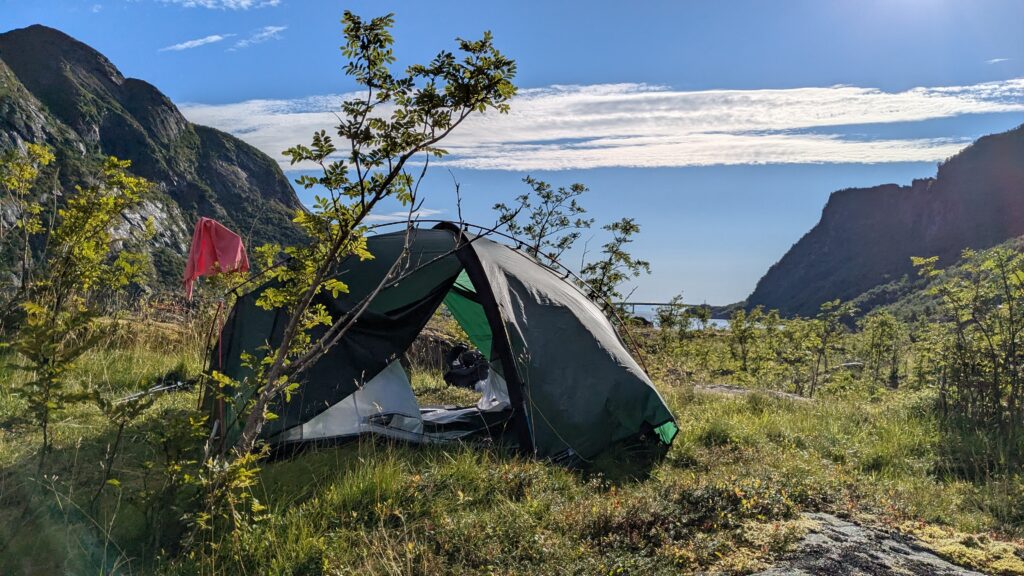
We made it to the start of the trail.
But with the weather the way it was, we didn’t go up.
We camped by the sea instead.
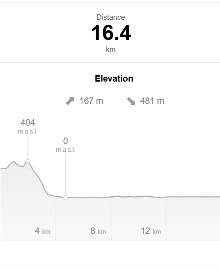
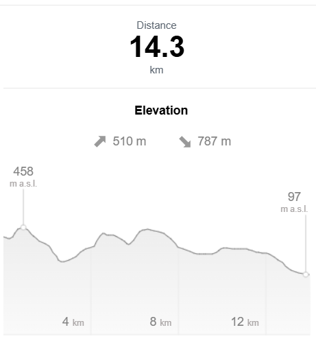
Stage I | Matmora to Leknes
Day 1 | Delp → Isvatnet
It rained through the night and into the morning.
The wind picked up fast.
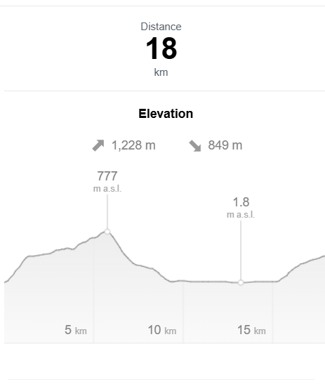
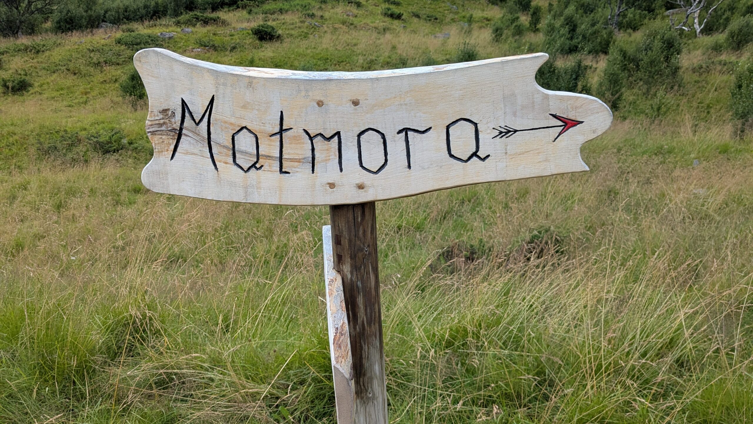
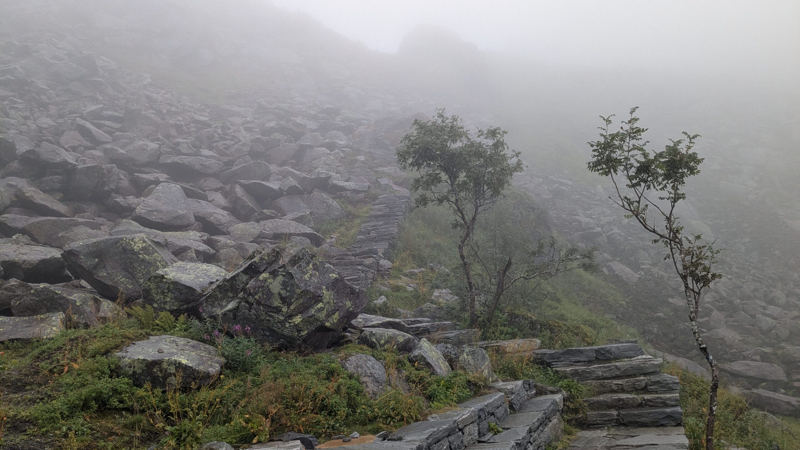
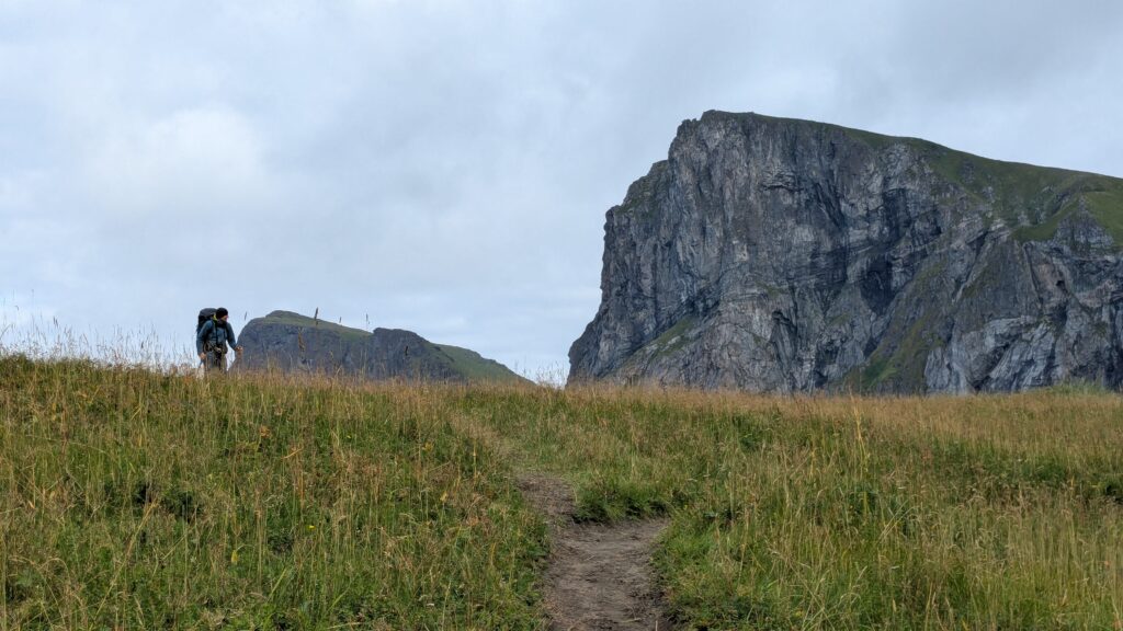
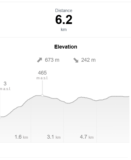
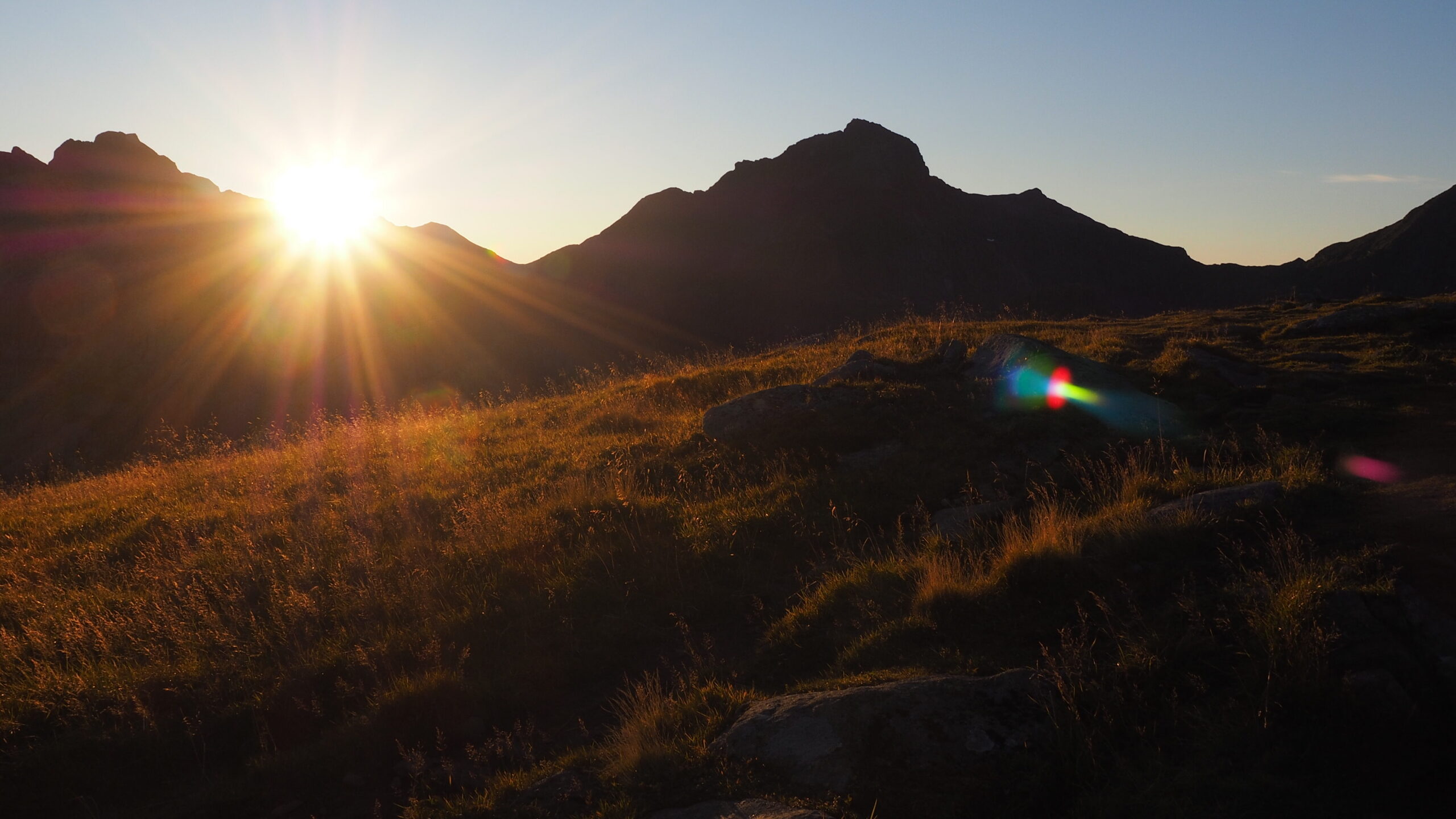
We camped right at the entrance to the Matmora Trail, so we immediately started climbing. 350 meters up, then another 400.
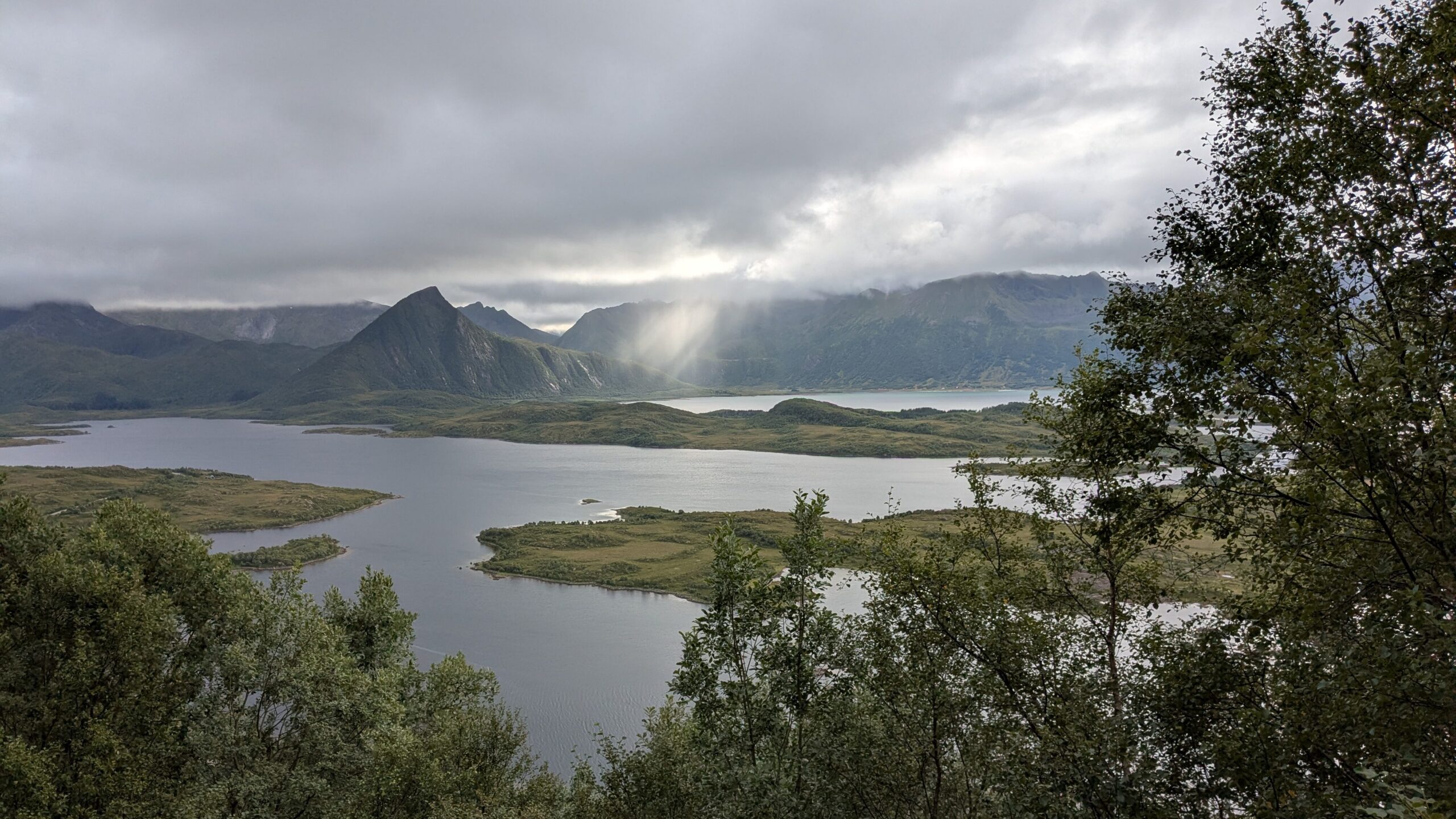
The higher we climbed, the thicker the fog.
From the top, a steep 800-meter descent.
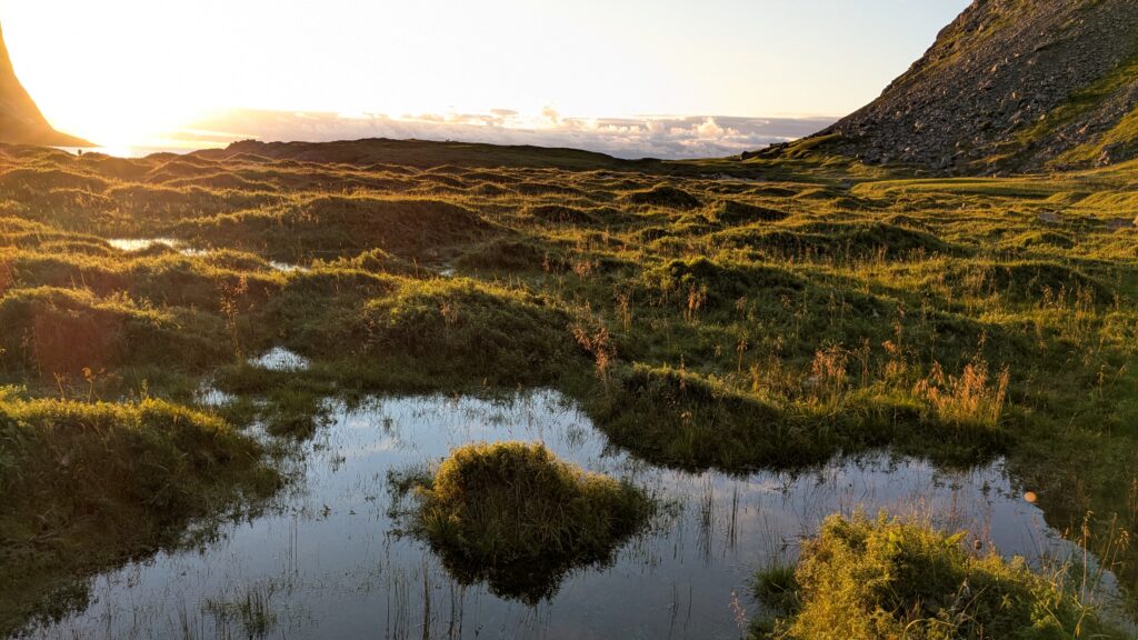
Then a few easier kilometers until we reached small lakes where we decided to stay for the night.
Sea on one side, lakes on the other.
Sunset breaking through.
Beautiful – and cold.
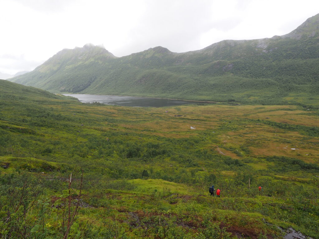
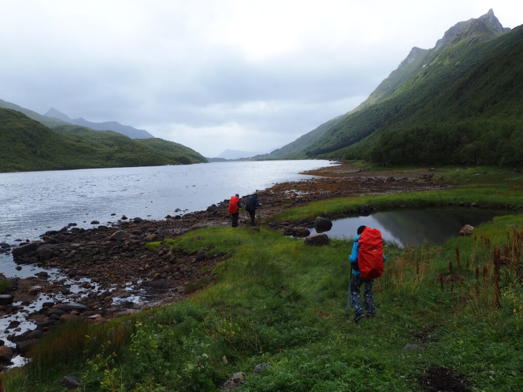
Day 2 | Isvatnet → Svolvær campsite
Rain again in the morning, so we didn’t start until around 1 PM.
Before leaving, two of us decided to swim in the lake.
Water temperature: 8°C.
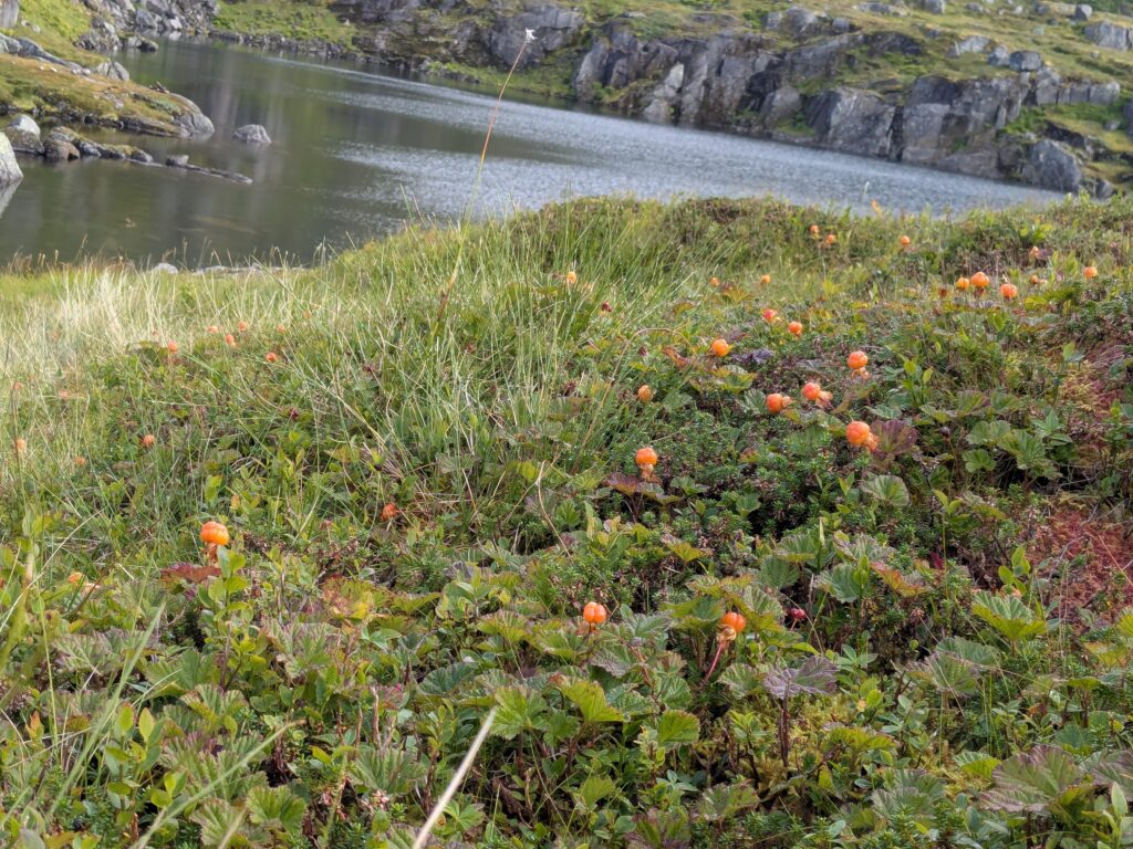
We filtered water, picked cloudberries growing all around us, and moved on.
The trail climbed again, crossing a fast-flowing stream.
We passed several small lakes before reaching Bostvatnet.
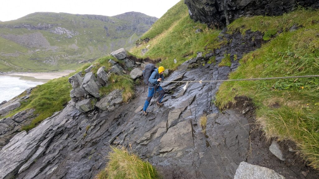
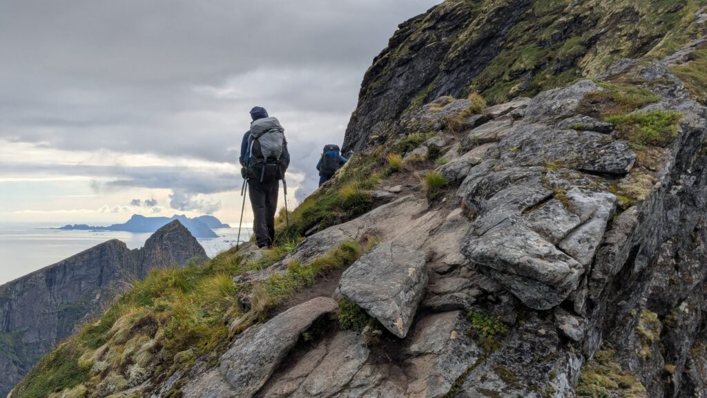
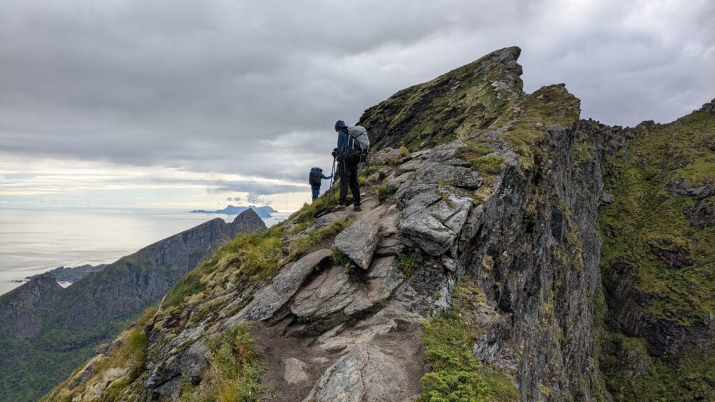
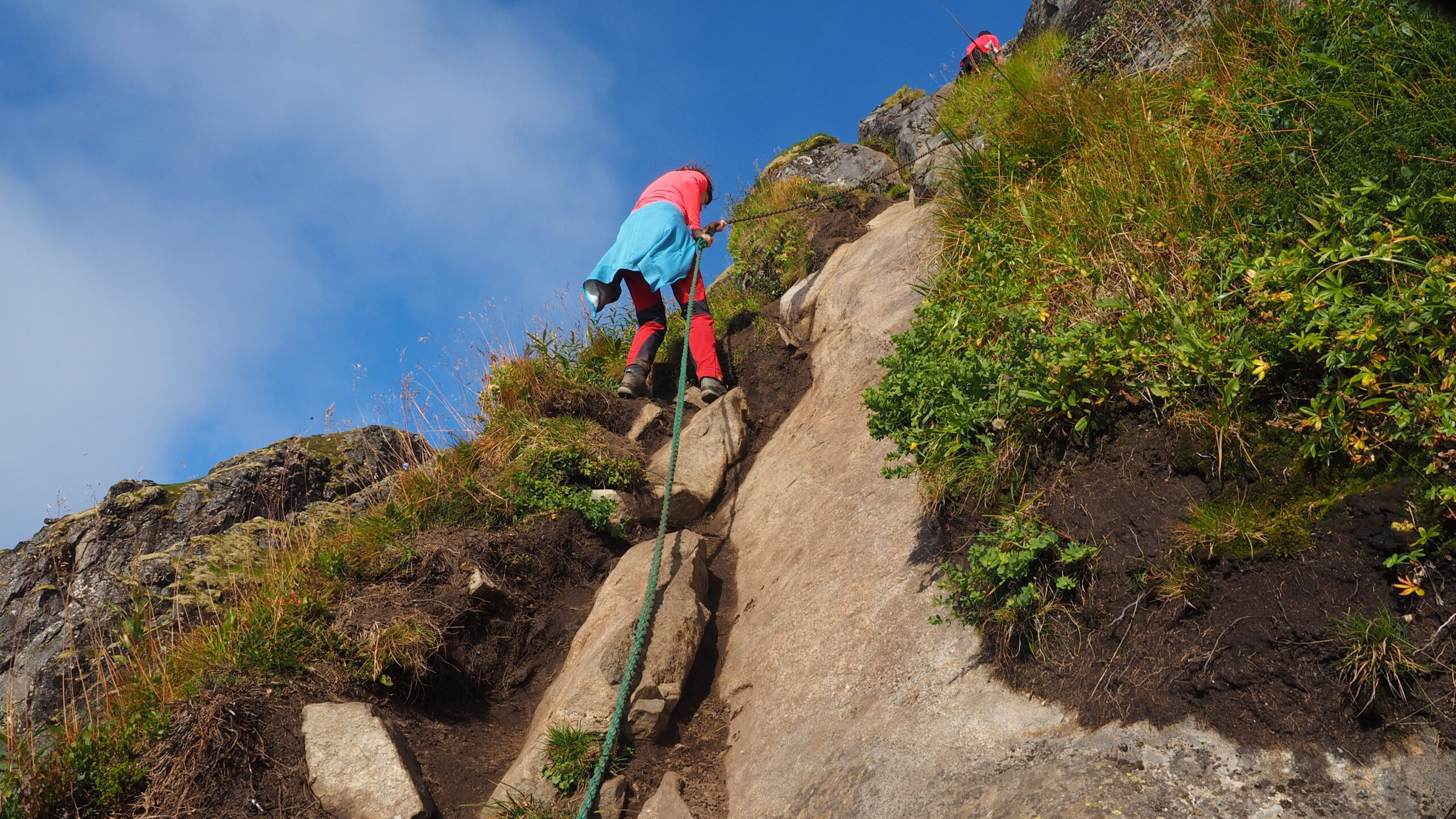
And that’s where it got exposed.
The path followed rocks right above the lake.
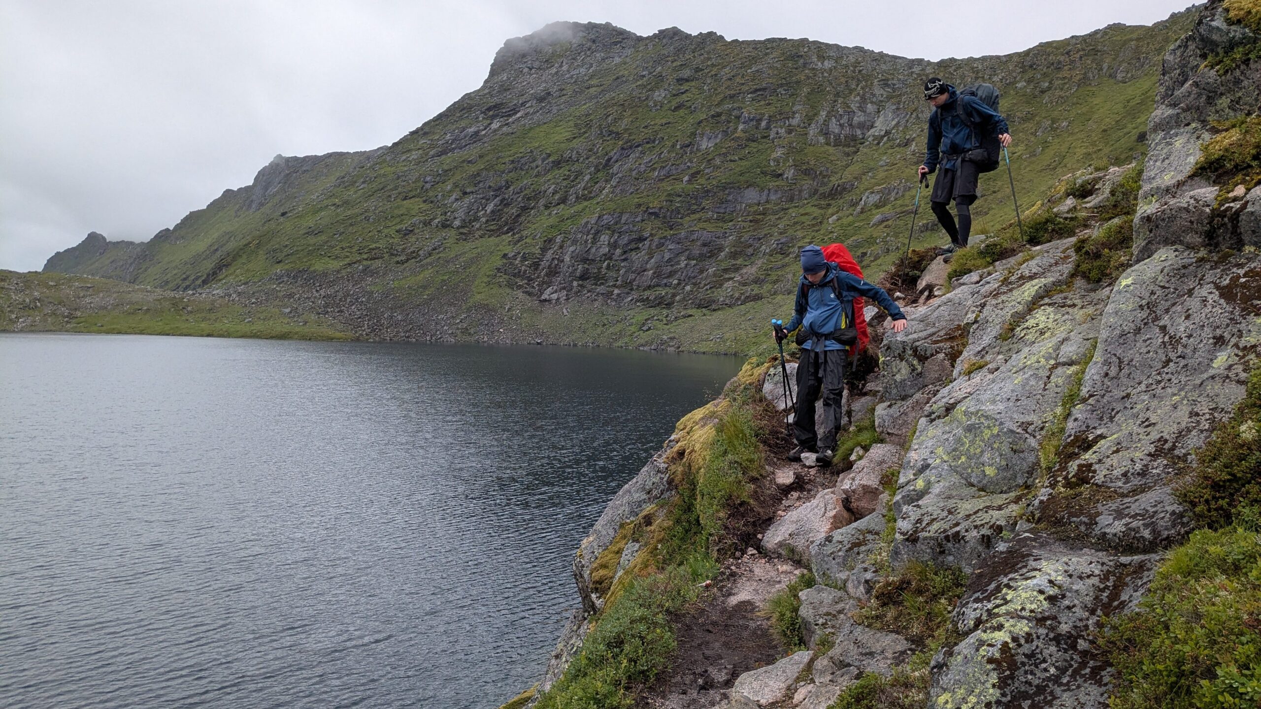
Then things got harder: wet boulders, moss, mud, heavy packs pulling us off balance.
I fell backwards twice.
The descent was even slower – less than 1 km/h.
With soaked boots and rain returning, we decided to stop at a campsite in Svolvær.
Laundry. Dry clothes. Warm kitchen.
A reset.
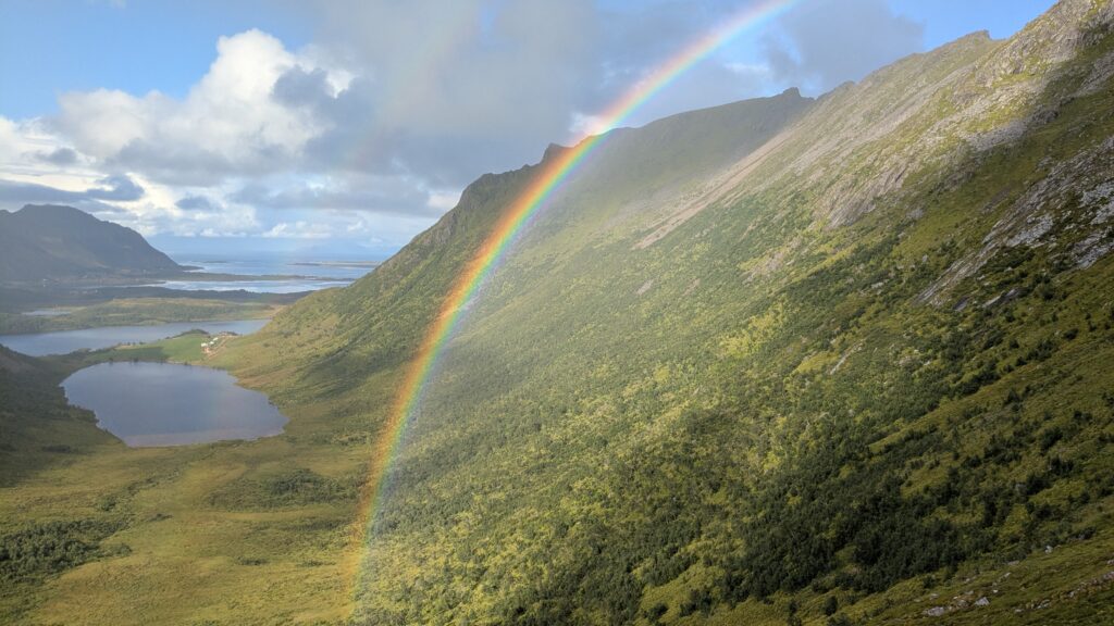
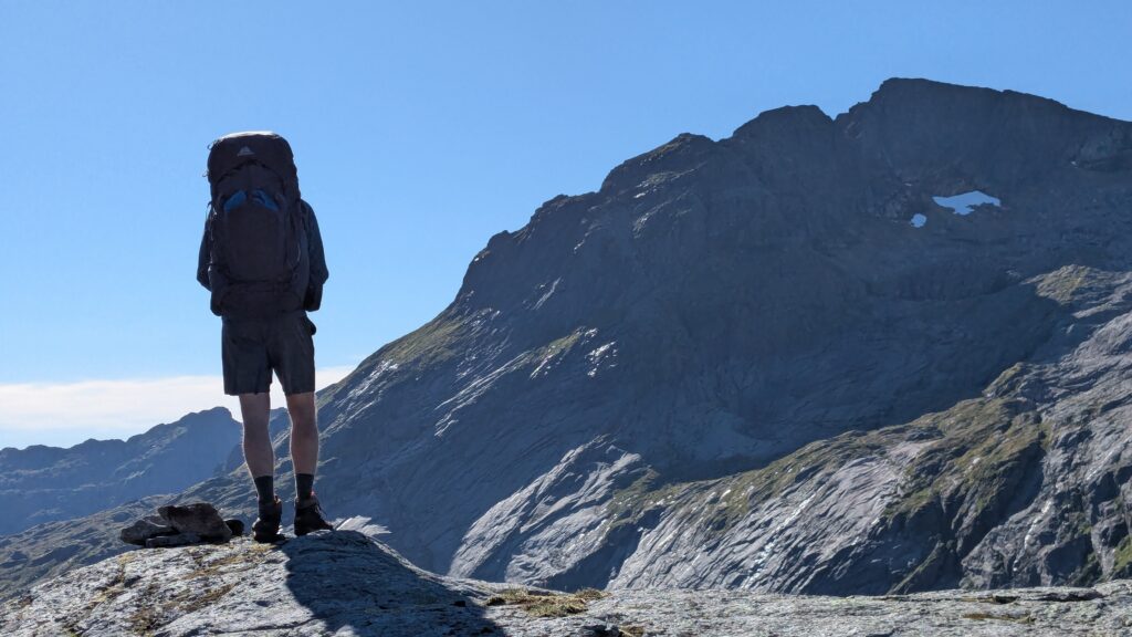
Day 3 | Svolvær → Fløya → Nokkvatnet cabin
We started easy, a nice hike to Fløya, just daypacks and snacks.
From the campsite, the trail went straight up – steep, around 170 meters in no time.
Then fog, light rain, and those incredible stone steps disappearing into the mist.
The climb was demanding even without backpacks.
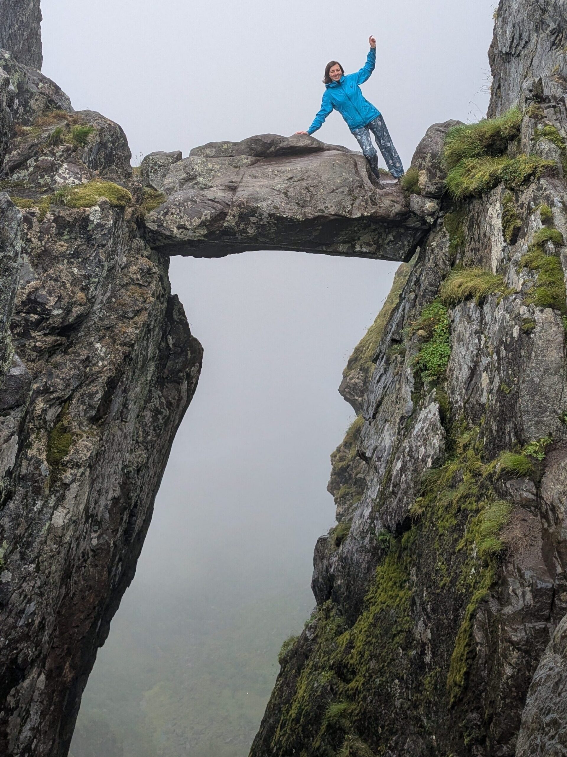
At the top there was the famous rock suspended between cliffs.
One by one, we took photos.
Looking down was… uncomfortable.
Back at the campsite, we ate, dried our gear, and around 16:30 decided to head out again – just 3 km to a lake where we planned to camp.
Simple plan.
It didn’t go that way.
The route first climbed steeply through mud and bogs, then descended over rock slabs, and finally followed a road.
But the lake we had planned to camp at, Stor Kongsvatnet, turned out impossible: surrounded by reeds, bogs, and wet ground. No place to pitch a tent.
Without overthinking it, we decided to go higher, to the next lake.
350 meters up.
Through ferns, bushes, across a strong stream, then climbing alongside what turned into a waterfall.
Then steep boulder fields.
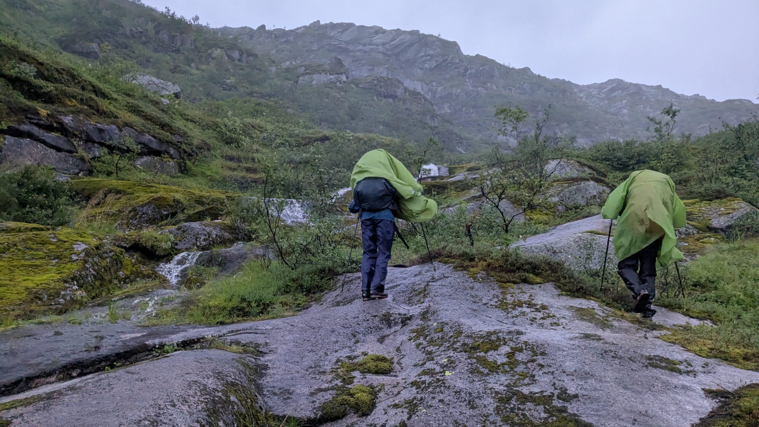
And then the weather broke.
Strong wind. Violent gusts. Heavy rain.
Ponchos flapping, tearing, covering our faces.
We struggled to stay upright, moving step by step uphill.
21:00… 22:00…
It was getting dark.
And serious.
No place to camp.
In the middle of nowhere.
Wind, rain, and fading light.
We knew we had maybe an hour before nightfall.
Finally, we reached the lake. Still nothing. No place to stay.
Wind around 80 km/h. Rain hitting sideways.
Wet, cold, exposed.
At some point, it stopped being uncomfortable and started feeling dangerous.
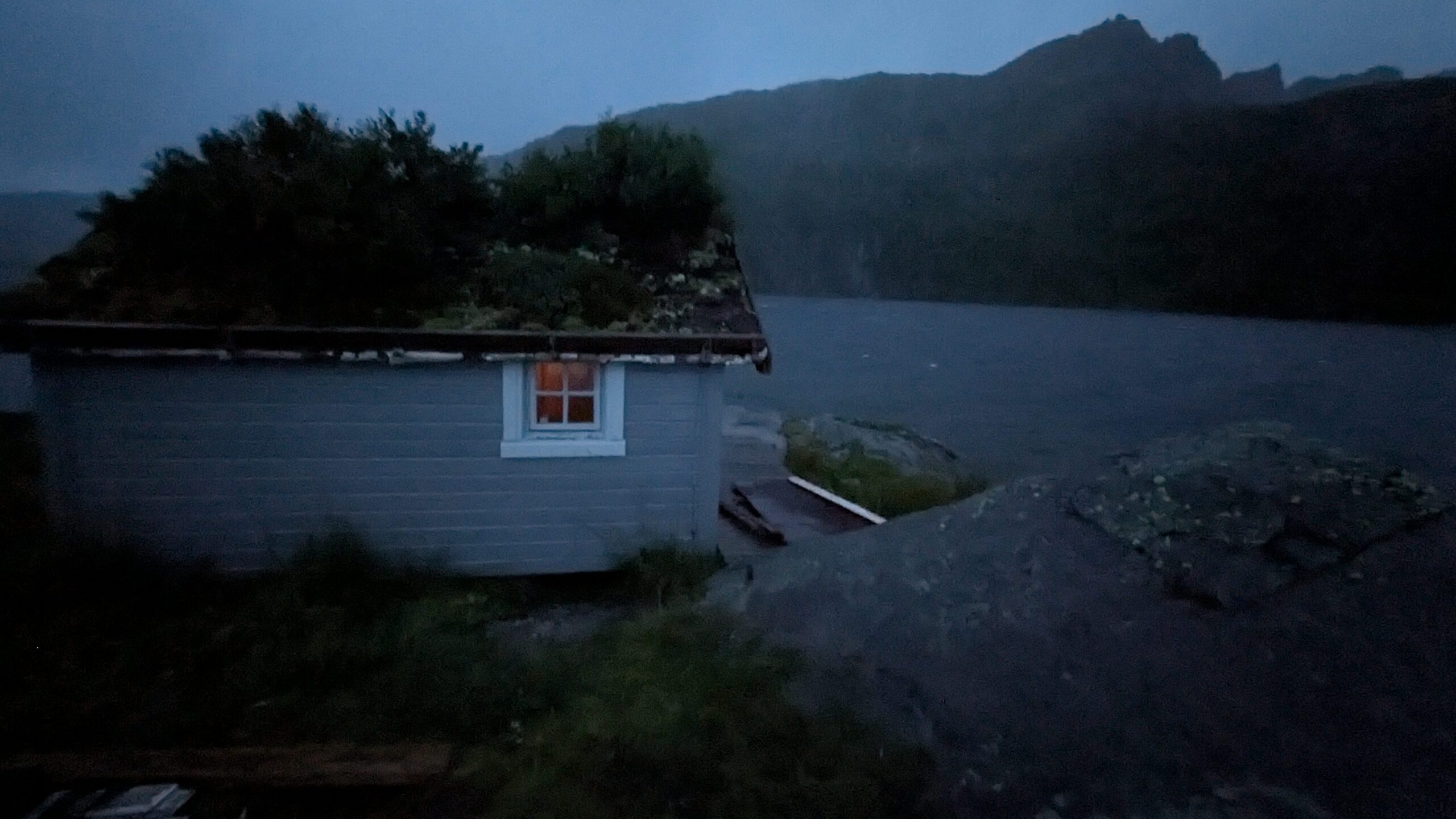
Then we spotted something on the other side of the lake.
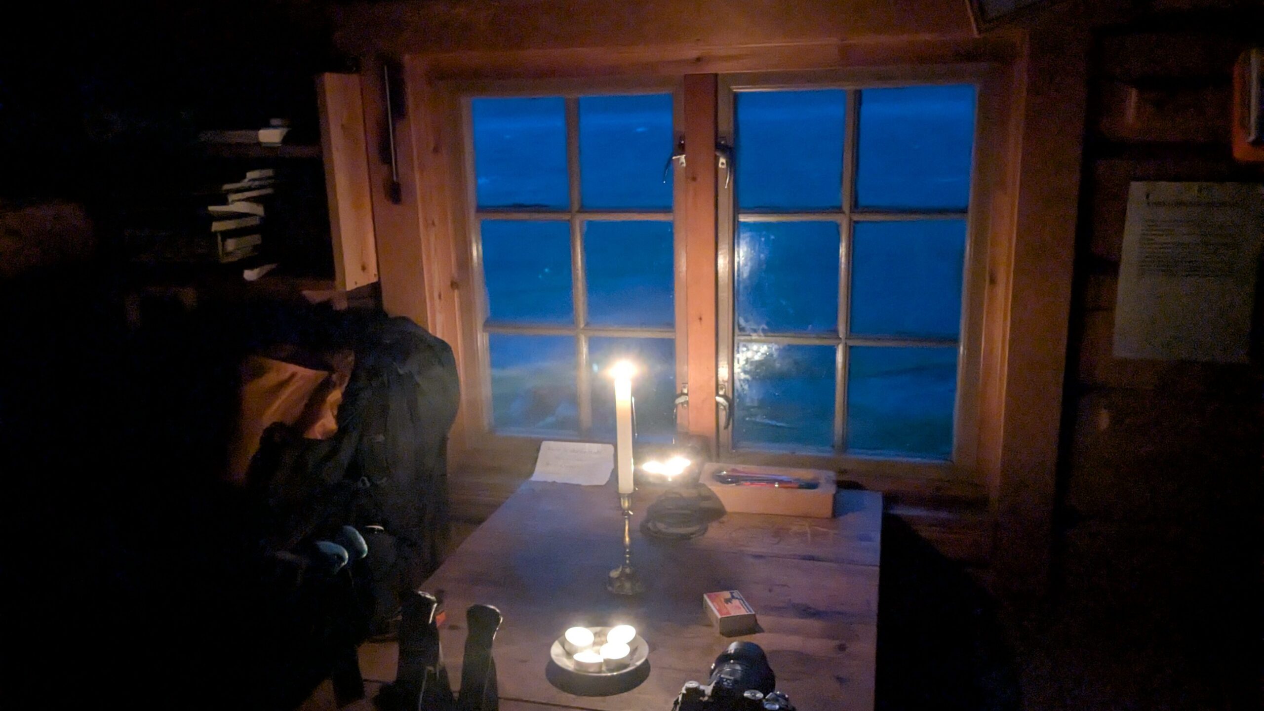
A cabin.
It saved us.
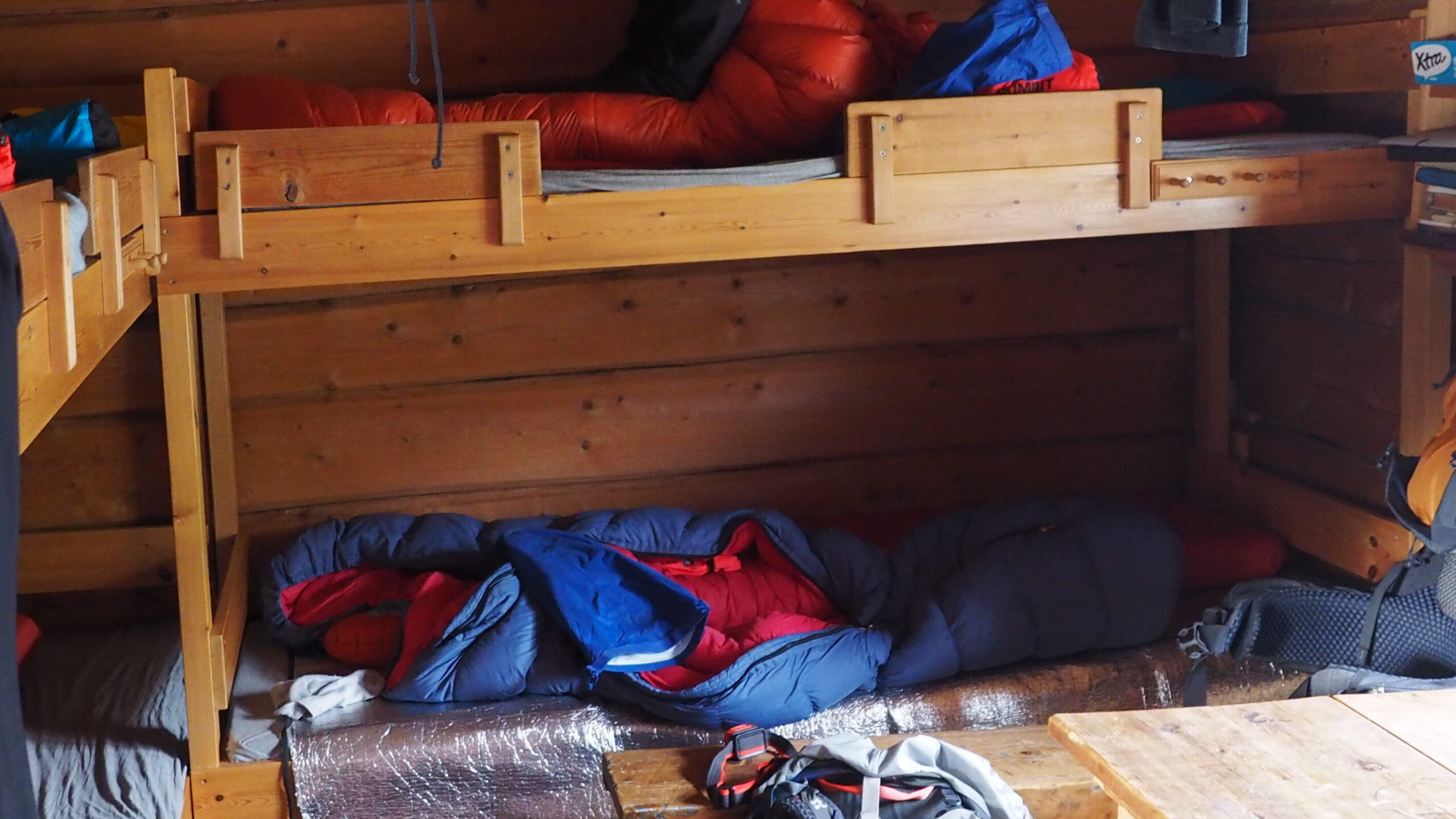
Four beds. A stove.
And most importantly – shelter.
That night, it really felt like someone was watching over us.
Day 4 | Nokkvatnet cabin (rest day)
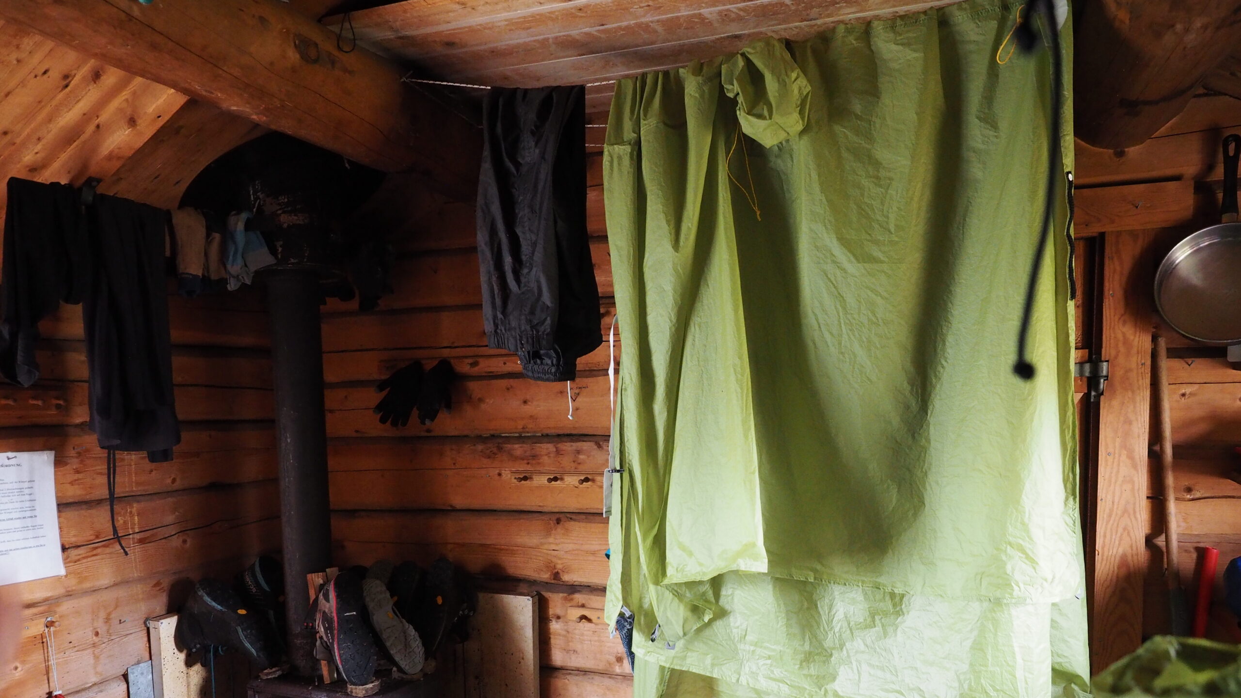
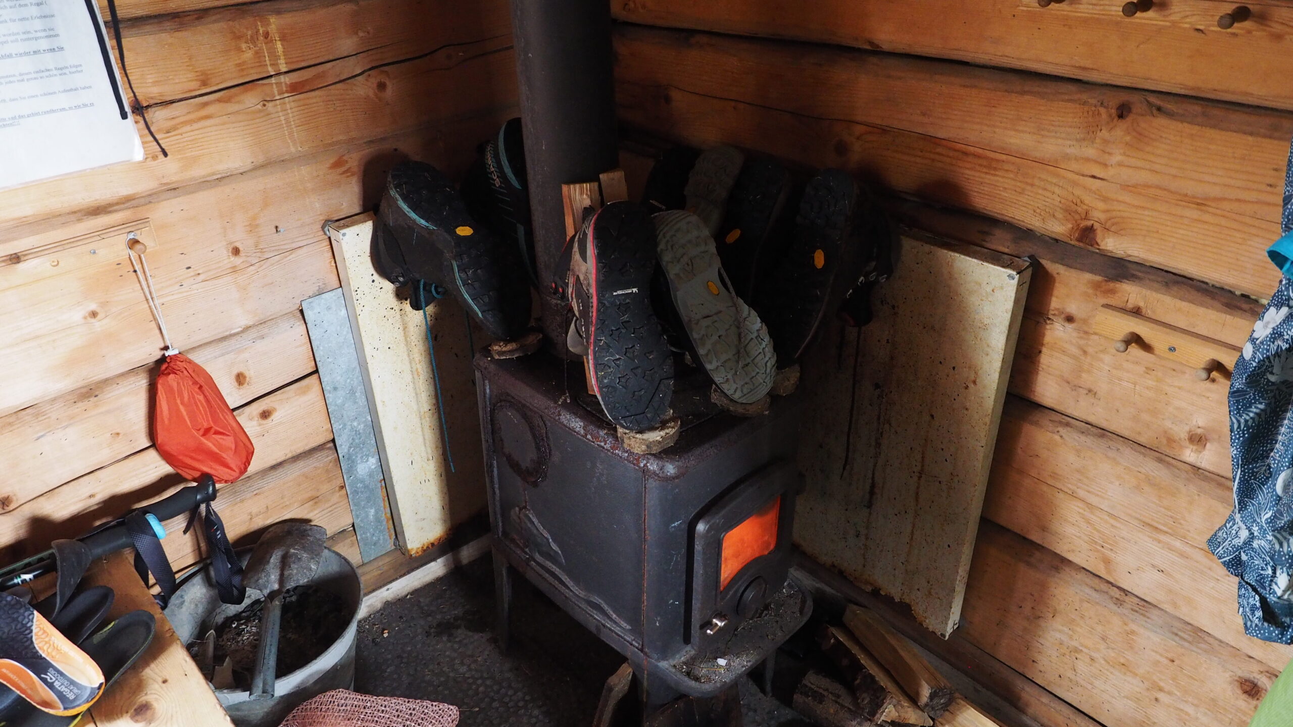
We stayed in the cabin all day.
Heavy rain outside – no reason to move.
We dried everything: clothes, gear, boots by the stove, slowly warming up.
People kept coming in: backpackers passing through, looking for shelter from the wind and rain.
They stopped, ate something, talked for a while, then moved on.
A quiet, shared pause in the middle of nowhere.
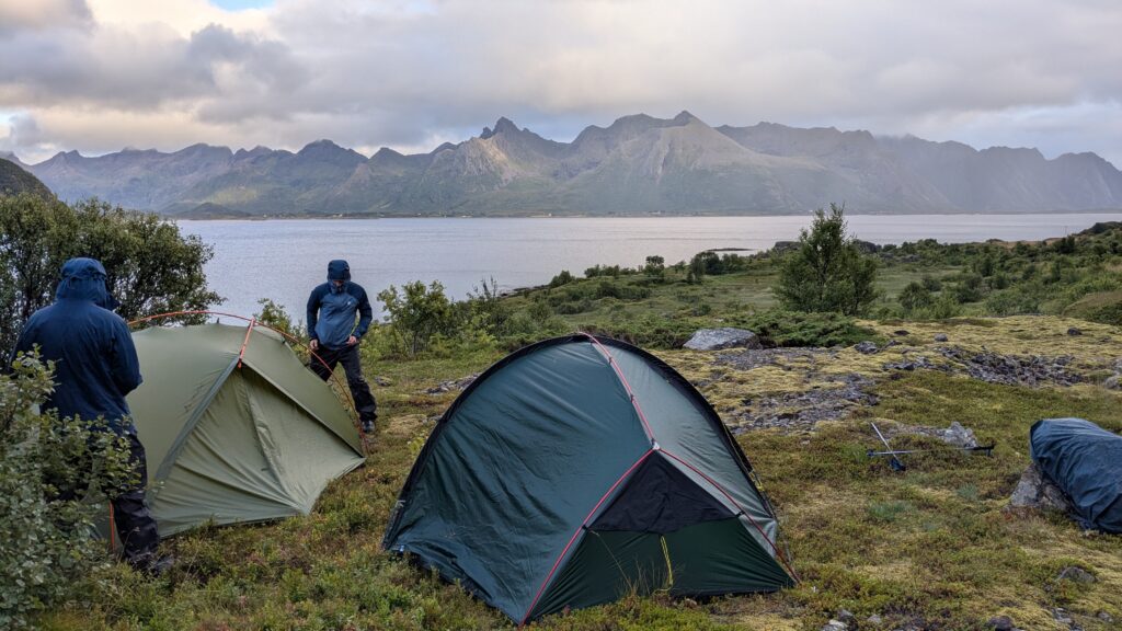
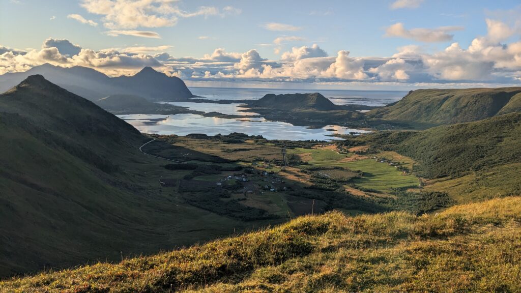
Day 5 | Nokkvatnet → Sunkat
In the morning, the weather improved, and we headed down – steep, muddy, across bogs.

We reached the E10 and took a bus for a few kilometers to Vestvågøya.
We got off at a small stop. It was 16:00. Cold. Rainy. We hadn’t eaten since breakfast.
That’s when doubts started.
One of us questioned whether we could make it through the mountains to Leknes in two days and whether we’d even find a place to camp.
The other agreed. After the previous experience, it didn’t feel like an unreasonable concern.
For a moment, the whole idea of the trip felt fragile.
We decided to go to Leknes by bus.
As we had just gotten off a bus going there, the next one was hours away.
We tried to find accommodation in Leknes – nothing. Completely full.
So we stayed at the bus stop. Cooked a meal. Put on every layer we had.
We warmed up, ate, regained some energy. With no other option, we started looking for a place to camp.
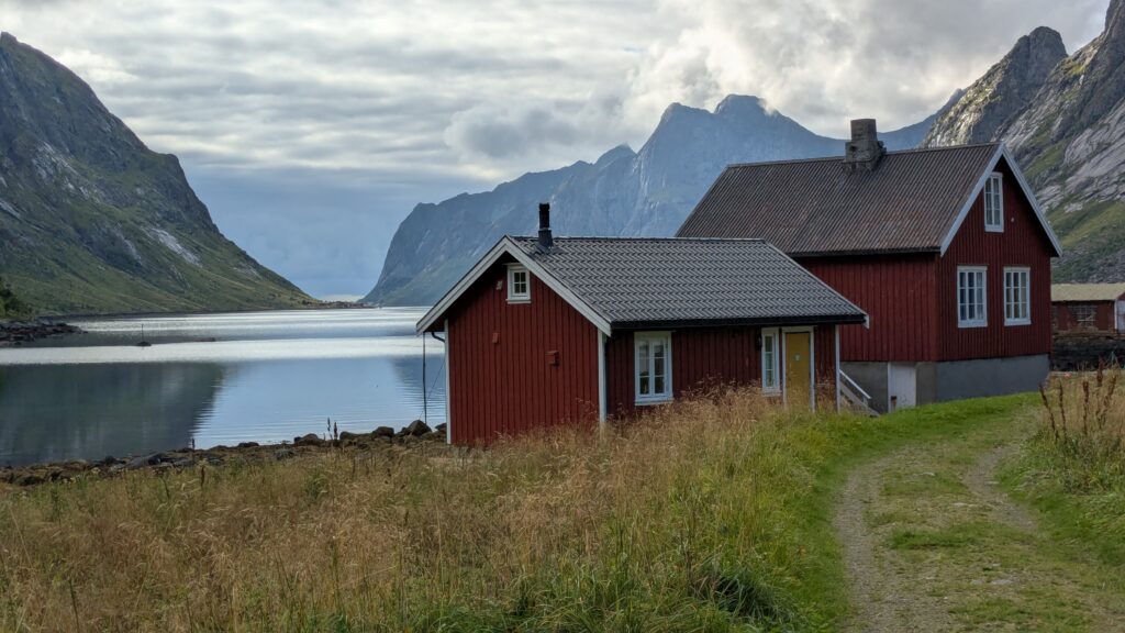
We found a beautiful spot for the night on a small peninsula near a bridge, right by the sea (check the location on the GPX track).
Later, already in our tents, warm and dry, we checked the route again.
We found a solid camping option ahead.
Decision made: we continue.
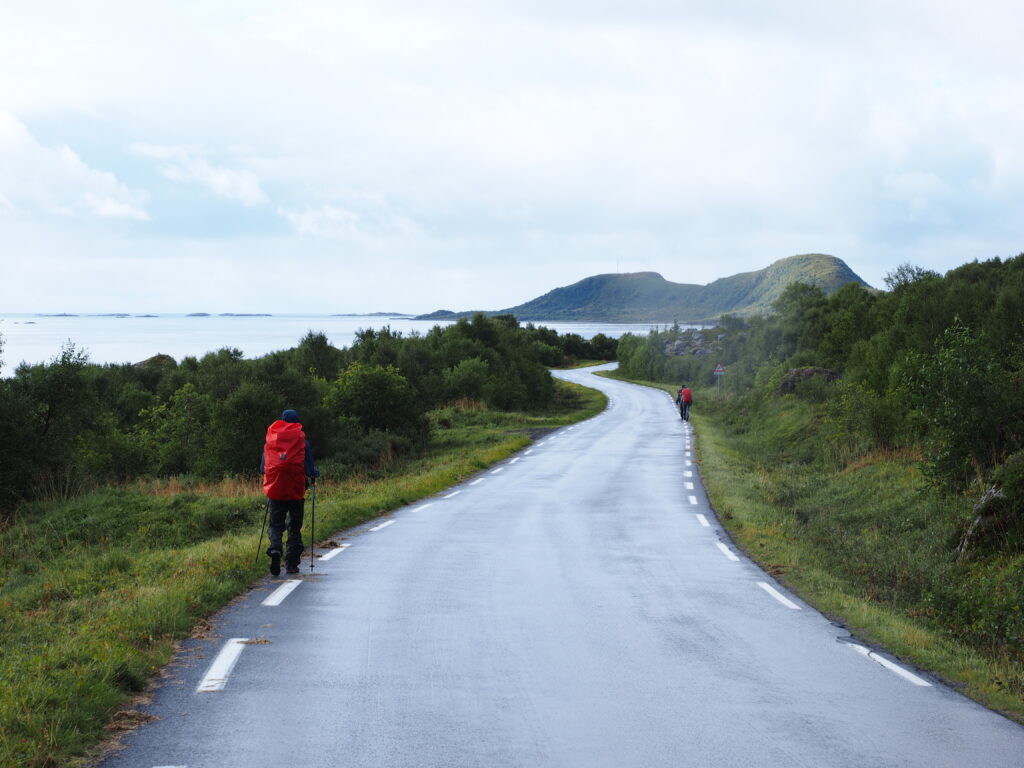
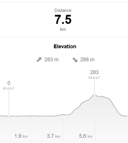
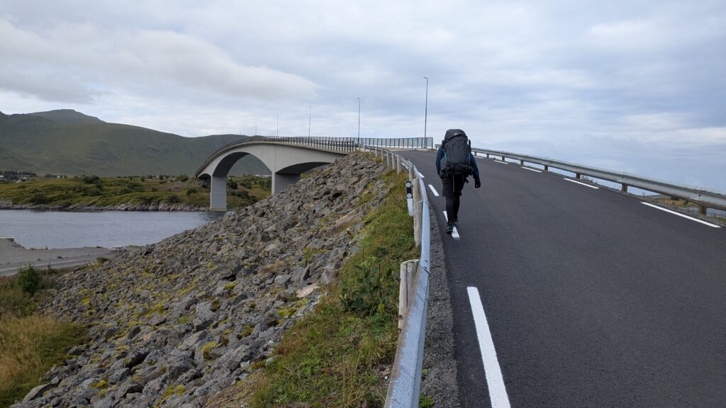
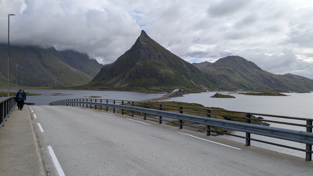
Day 6 | Sunkat → Brattfloget
Light rain in the morning, but the forecast looked better.
We had breakfast under the tarp and started walking.
6 km of asphalt before reaching the trail.
We split again: hitchhiking and walking.
Met later at a small cafe called Rebecca, run by two young Poles.
Hot potato soup with focaccia and wild garlic pesto.
And blueberry buns.
Simple things. Perfect timing.
We stocked up and moved on.
The trail was beautiful.
And finally – sun.
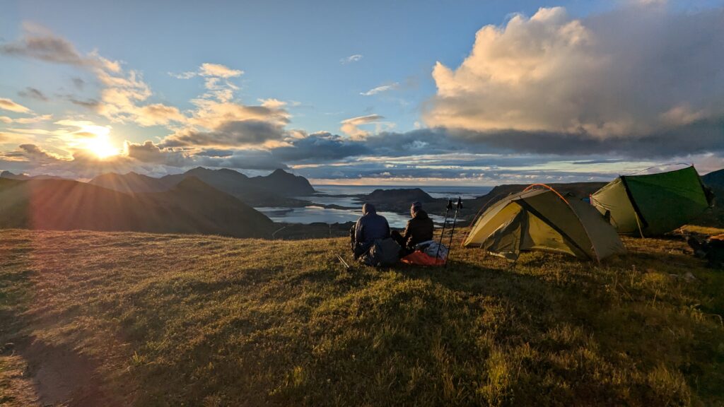
We camped on a plateau near Brattfloget.
Incredible views. Sunset. And freezing cold.
Day 7 | Brattfloget → Leknes
Up at 6. Moving by 7. There was no water source nearby, which meant no breakfast.
On the way, about an hour later, we refilled our bottles from a stream and stopped to eat.
Oatmeal with fresh blueberries – there were so many around us!
The trail was mostly descent toward the town.
Wetlands, soaked ground. Wet shoes.
Finaly in Leknes. We booked two nights.
What we expected to be a small apartment turned out to be a full house – two floors, 80 m².
We dried everything. Showered. Did laundry.
Ate big pizza.
And rested. For the whole day.
Day 8 | Leknes (rest day)
A full rest day.
Exactly what we needed.
Stage II | Fredvang Kryss to Kjerkfjord
Day 9 | Fredvang Kryss to Kvalvika
We had to take a bus out of Leknes – part of the route goes through a tunnel where walking isn’t allowed. Since we had two extra days beyond our original plan, we had to skip Flakstadøya.
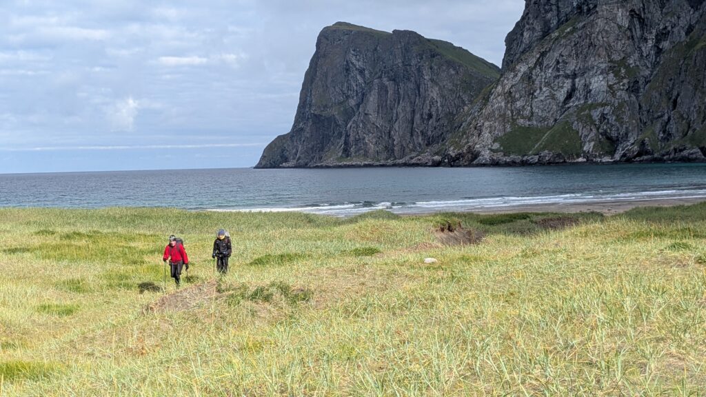
We got off at a junction Fredvang Kryss and continued on foot, about 3 km to the next island.
Then the trail to Kvalvika Beach.
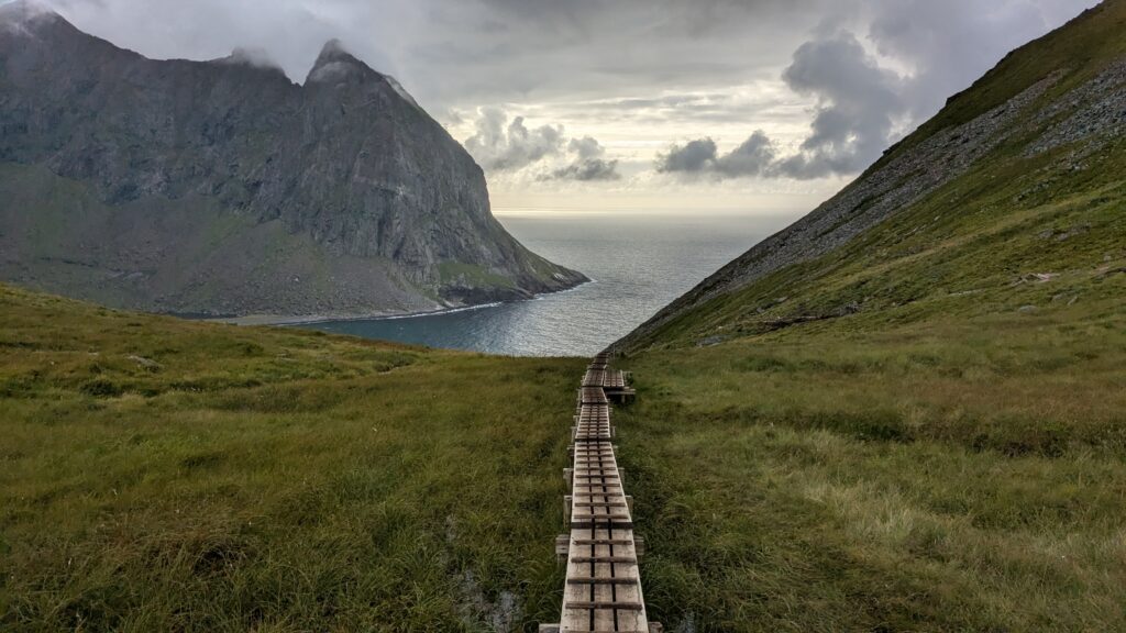
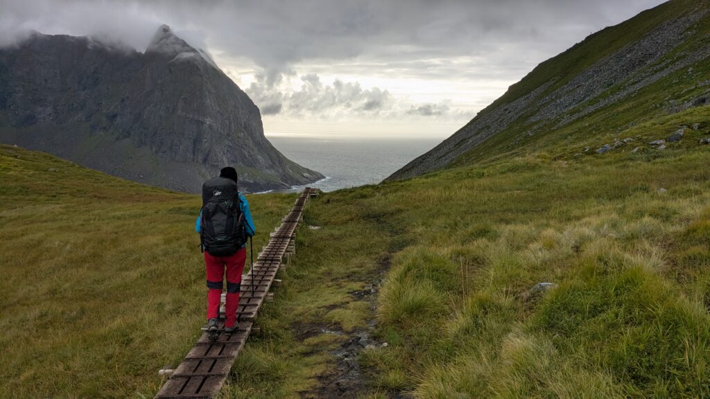
Very popular.
Parking lot at the start. Groups of tourists. Wooden boardwalks over wet ground.
Then long, long downhill.
From above, the view was incredible. Cliffs, ocean appearing in the distance.
It all looked close. It wasn’t.
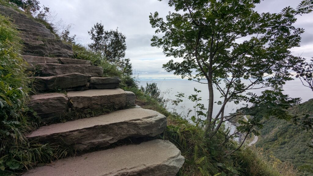
First boardwalks, then stone steps, someone counted 872.
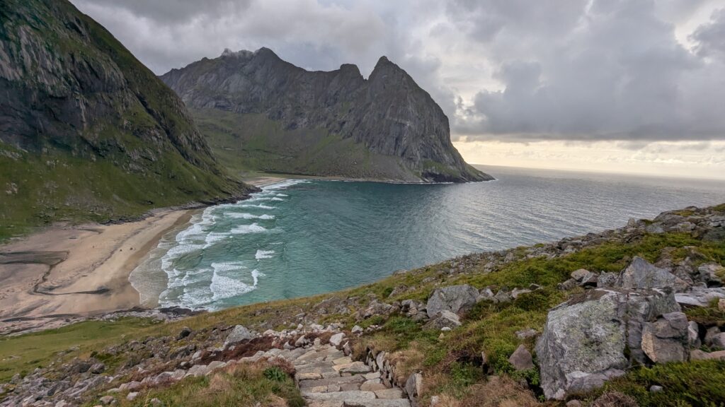
On the beach a few tents. Too many for us.
So we kept going, to the next beach just beyond.
That turned out to be the hardest part of the day.
Steep descent over rocks, narrow path along a cliff.
One section required pulling yourself up onto a rock.
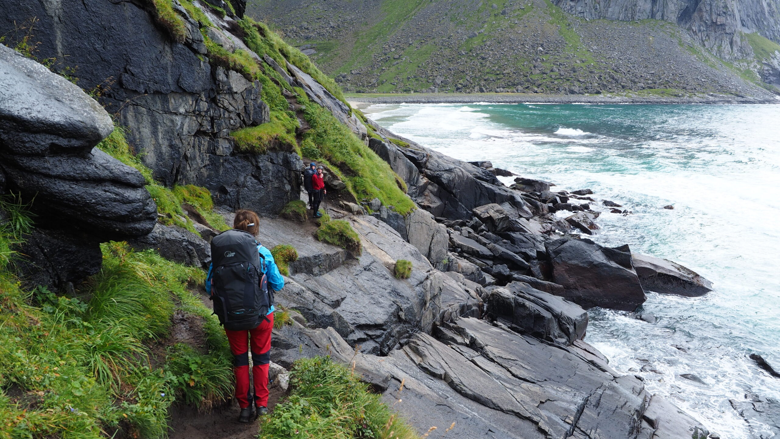
The second beach, Vestervika, was quieter, almost empty.
We stayed there for the night.
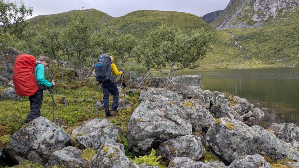
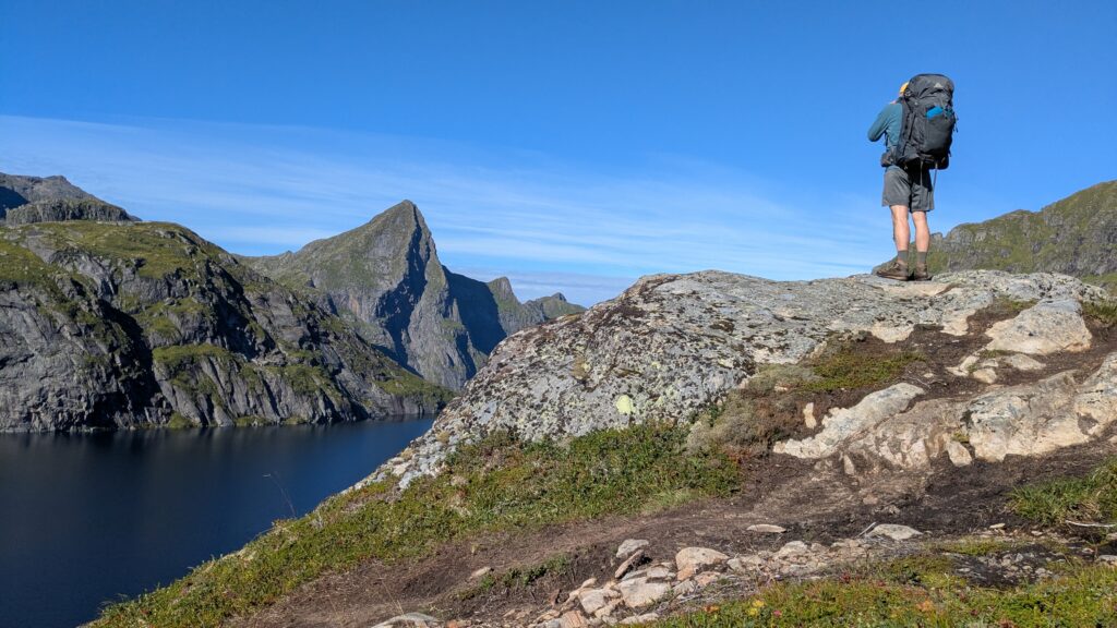
Day 10 | Kvalvika → Horseid Beach
We climbed up from the beach, steep but steady.
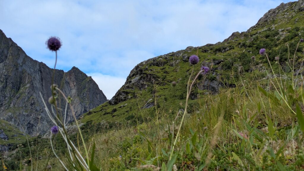
Then a beautiful stretch: lakes, rocks, warm weather, open space.
Fantastic views.
From above, we saw Horseid Beach. It looked perfect.
At the junction, we had a choice:
- left – mountain pass and ferry
- right – the beach
We chose the beach.
It was supposed to be easy to reach. It wasn’t.
Wet meadows, water everywhere. Shoes soaked again.
Then dunes, green, uneven, almost surreal.
We walked for a long time.
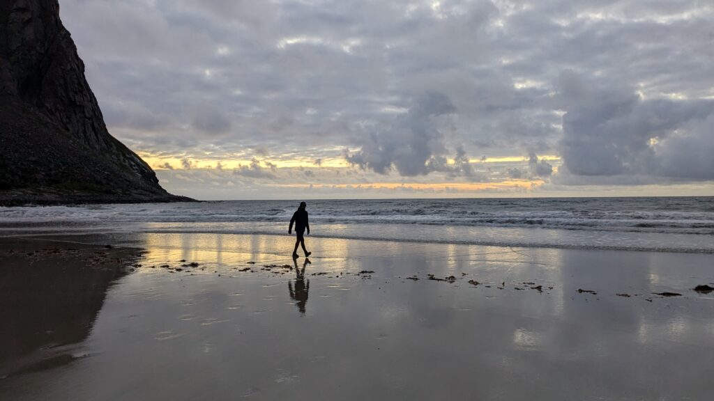
Arrived at sunset.
Wild. Quiet.
We camped on a rocky ledge above the beach.
An incredible place to spend the night.
Stage III | Reine – Moskenes
Day 11 | Horseid Beach → Djupifjord
We started early to catch the ferry.
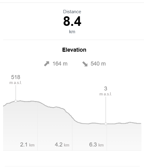
First back to the trail, then 170 meters up to the pass.
Breakfast while waiting at the dock.
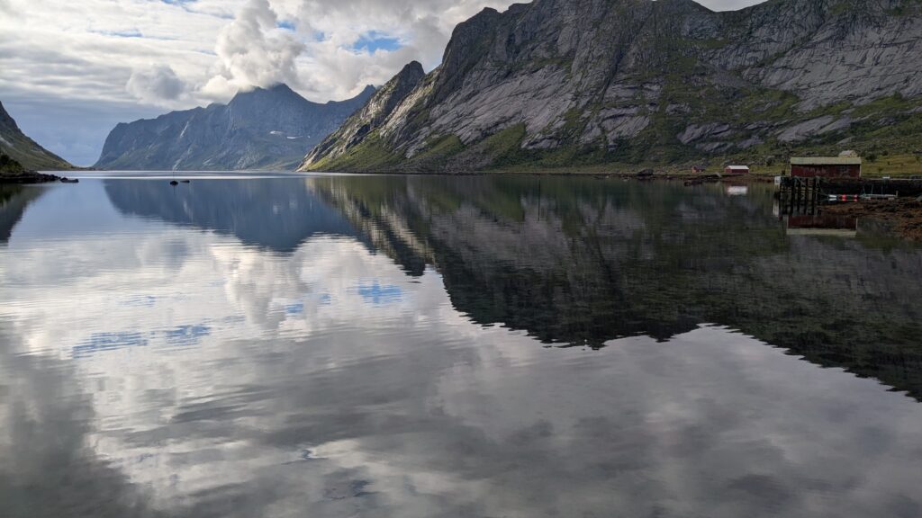
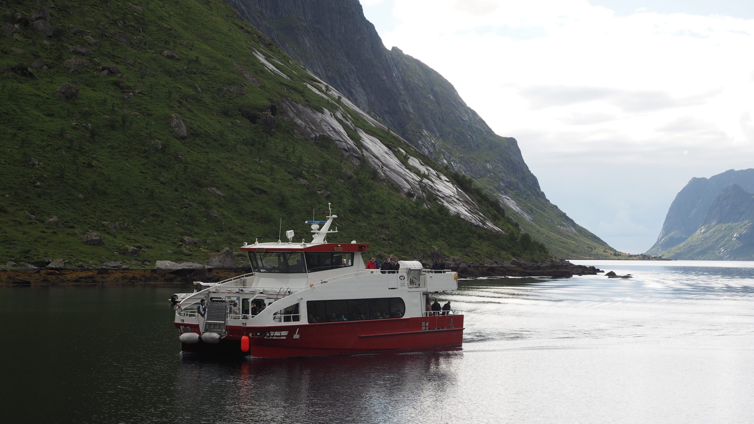
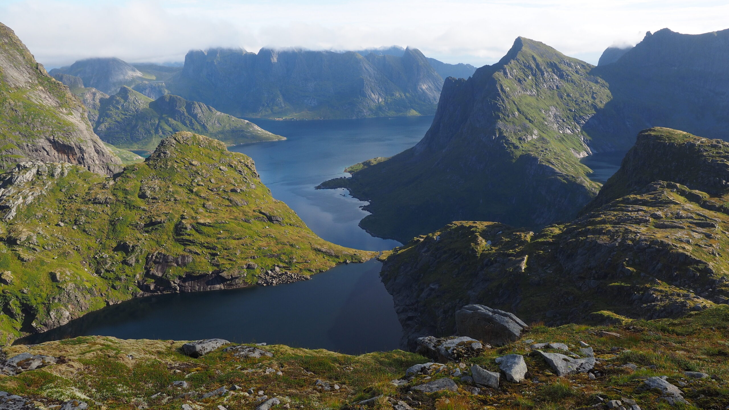
We sailed to Reine via Vindstad.
Originally, we wanted to start from there and climb directly from the fjord, but after reading about it (steep, almost vertical), we changed plans.
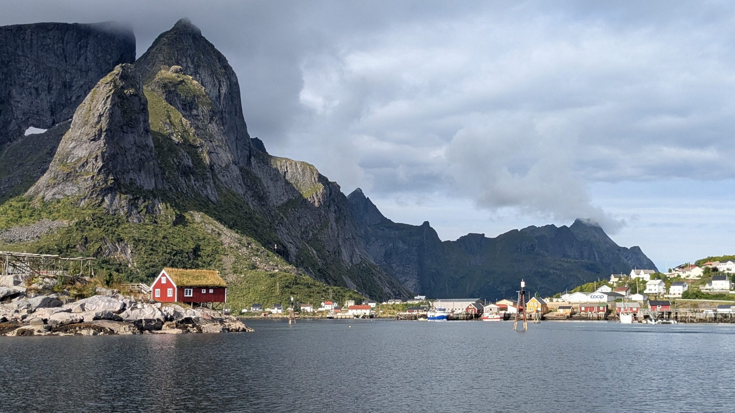
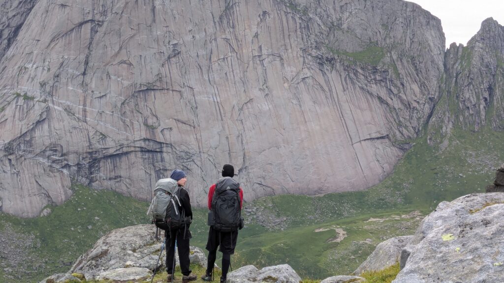
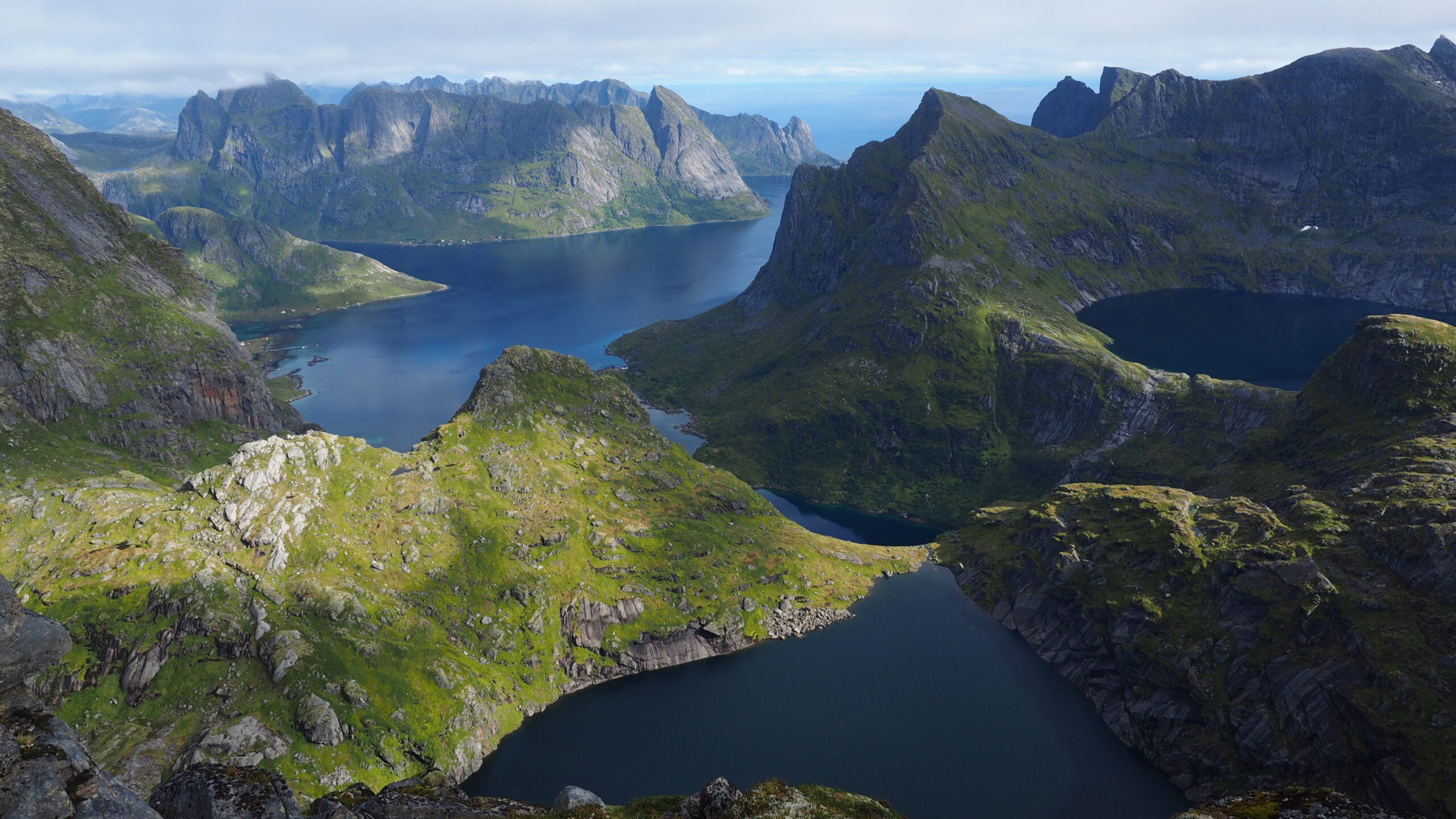
Reine. Reinebringen.
2,000 stone steps.
Crowded. Like a mountain highway.
But the view worth it.
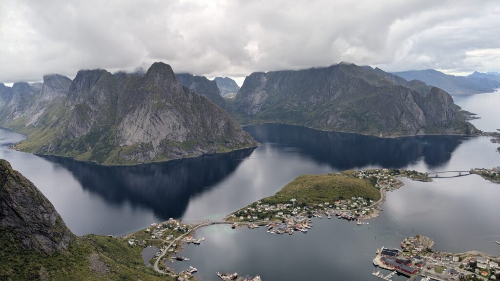
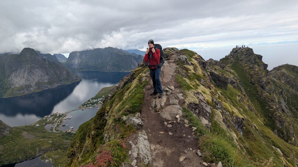
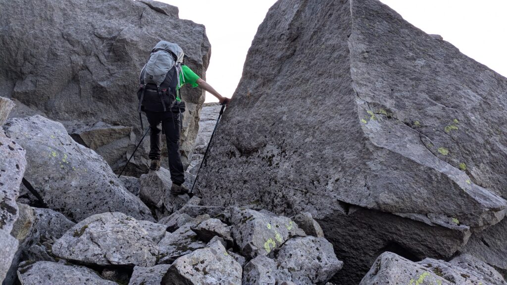
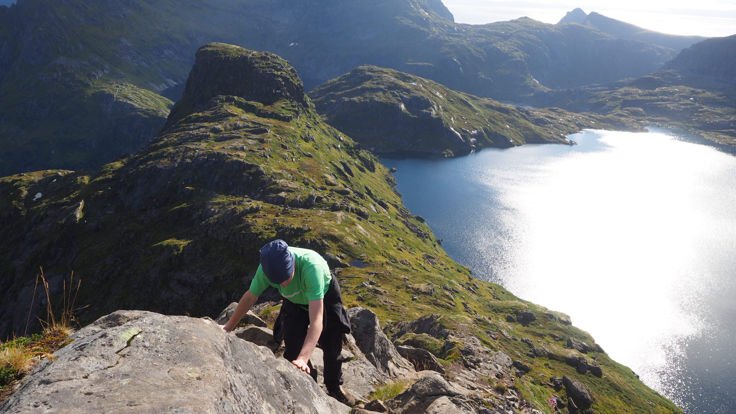
From there, we decided to continue along a narrow ridge, leading to even higher peaks, and go to the camp through the mountains.
Even getting down from the first peak was difficult.
Steep terrain, passing backpacks between us.
Then the ridge.
Exposure on both sides.
I was scared.
The views were overwhelming, but so was the exposure.
We moved carefully, helping each other, passing backpacks in tricky sections.
At one point, it started being too hard. Too risky.
One of us went ahead without a pack to check the route.
He came back with a clear answer: we won’t make it.
Even he had trouble getting back.
We stood there, above the drop, and made the decision.
We turn back.
So we retraced our steps, back to the summit, then down the stairs to Reine.
From there asphalt road, then toward the fjord.
And finally, about 1.5 km along the fjord to a lake where we decided to camp.
It took us two hours.
Rocks, mud, branches, bushes. Slow, exhausting.
But the camp – peaceful.
A quiet end to a very long day.
Day 12 | Djupifjord → Plateau below Hermannsdalstinden
We woke up at 8.
Sunlight. Blue sky. Warm air.
For the first time on the entire trip.
We went for a swim in the lake. Cold, refreshing, perfect!
Then straight uphill.
The views kept opening with every step.
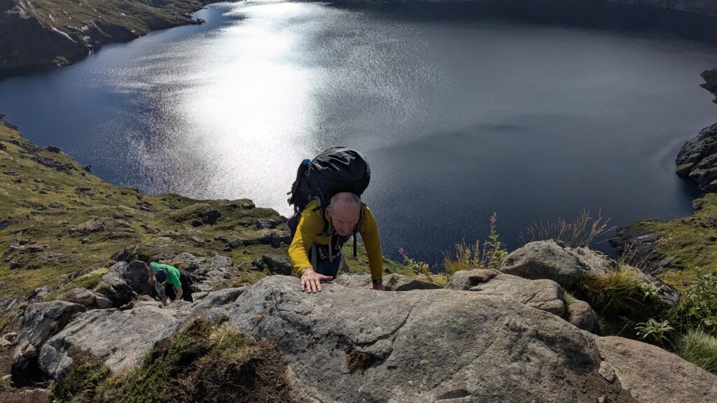
Up, then down to another lake, then climbing again, this time between massive rock formations.
At a stream, we stopped to filter water. It took us an hour.
Above this point, there would be no water. What we carried had to last for two days.
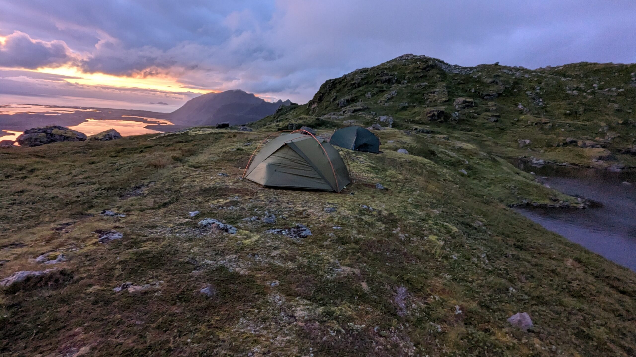
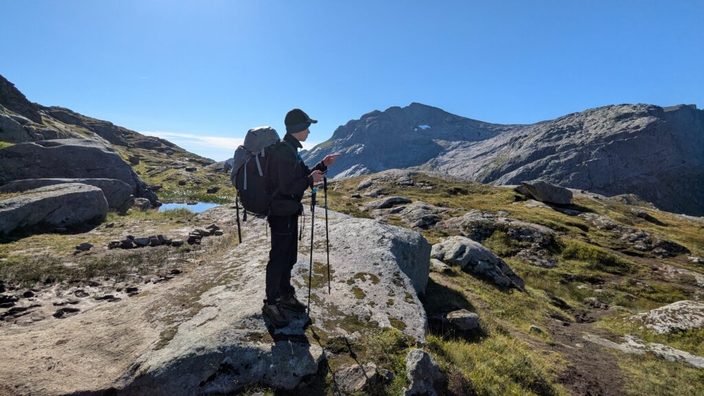
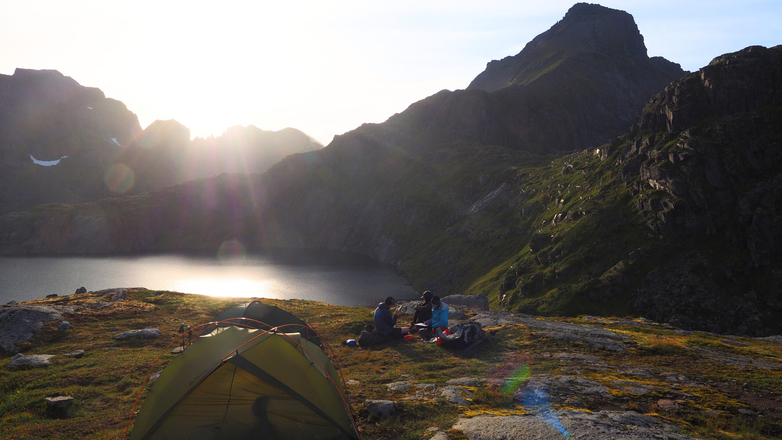
We reached a plateau below the summit.
Quite a few tents already there.
We set ours as close to the peak as possible, with a view of Hermannsdalstinden.
The sun broke through the clouds just in time.
Day 13 | Hermannsdalstinden → Moskenes
We went to sleep early — around 19:00.
The plan was clear: summit in the morning.
But in the morning, something felt… strange.
None of the other people camping nearby were heading up.
Too difficult, they said. Not worth it.
For us, it was the main goal.
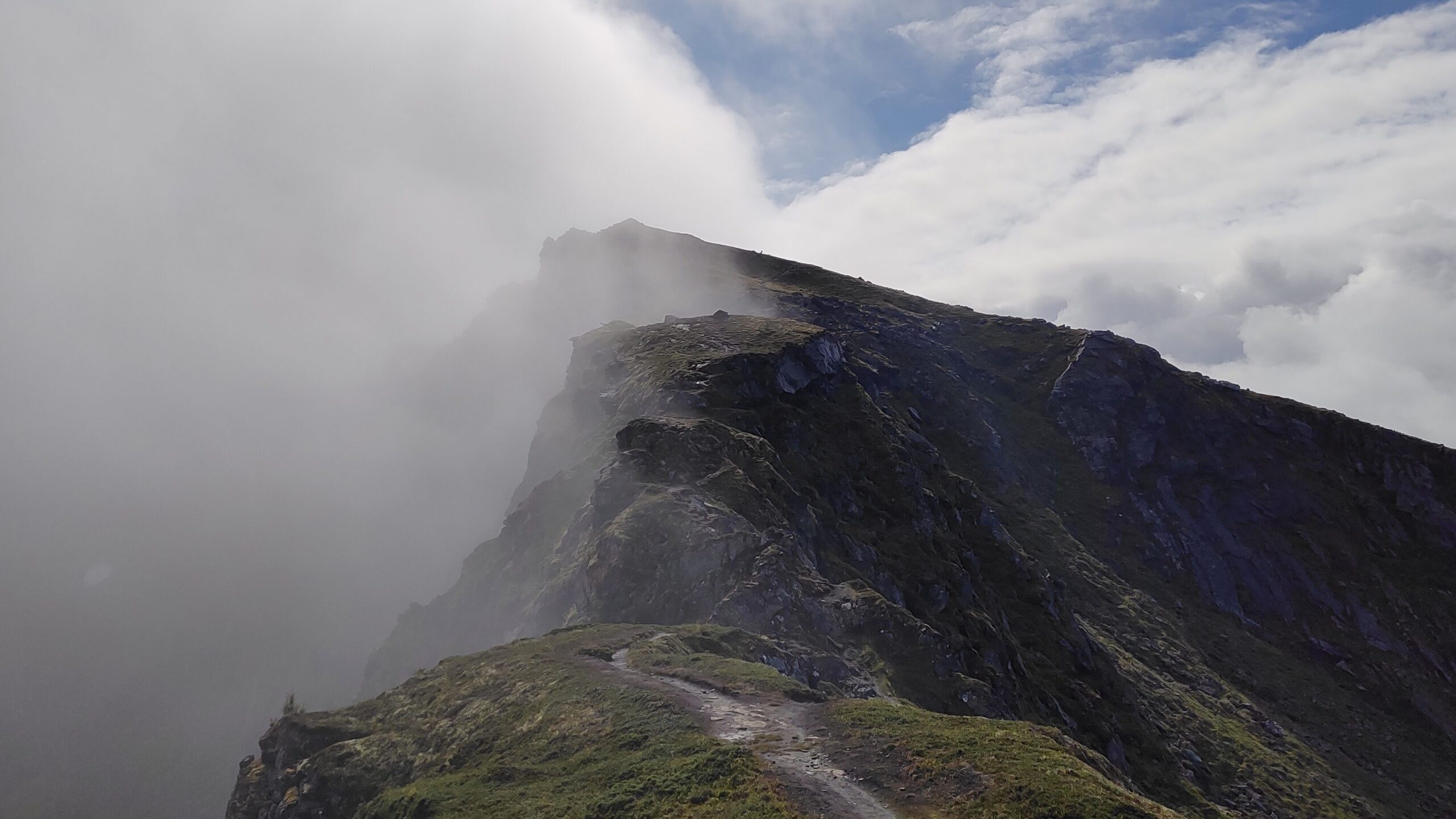
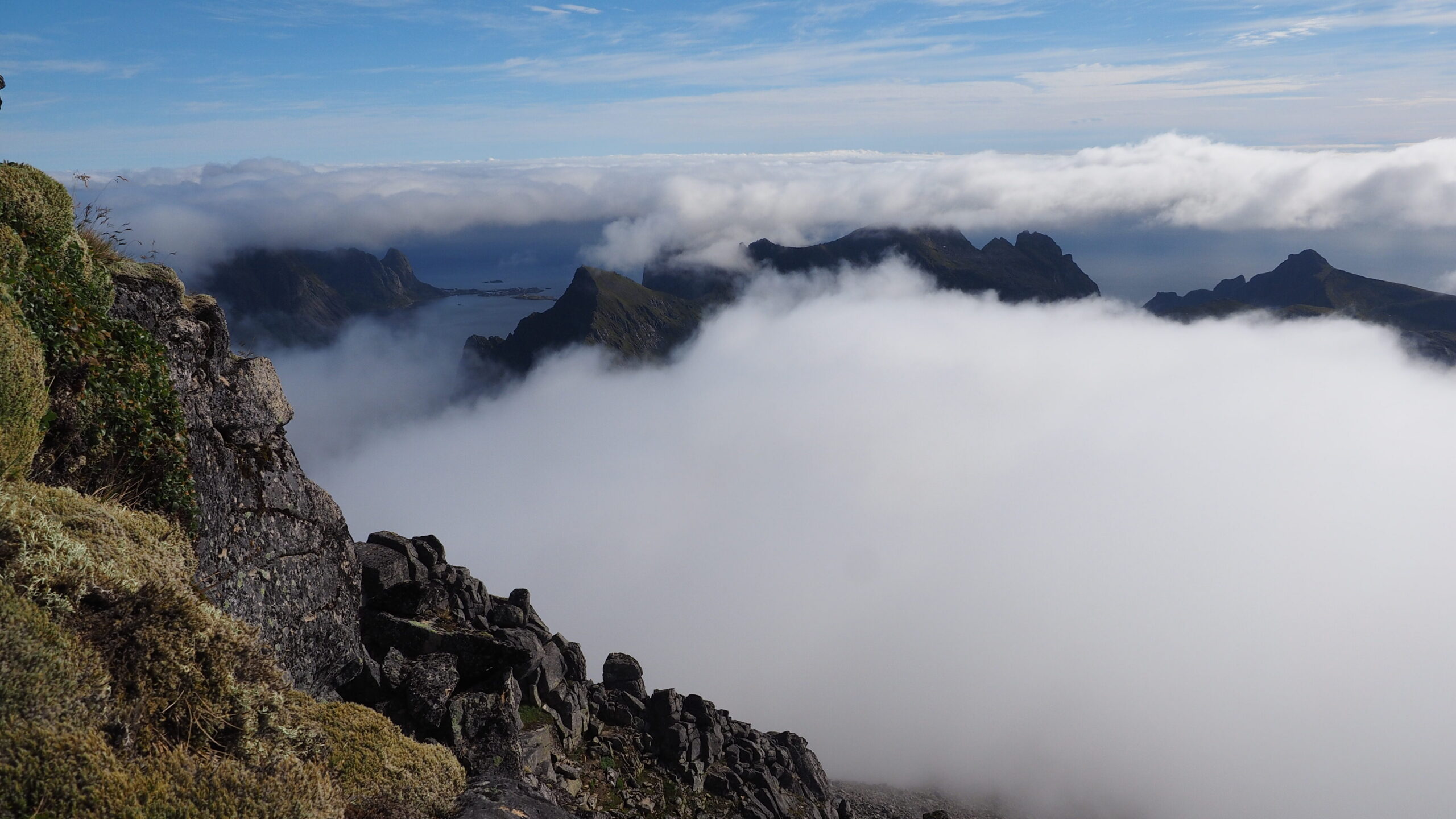
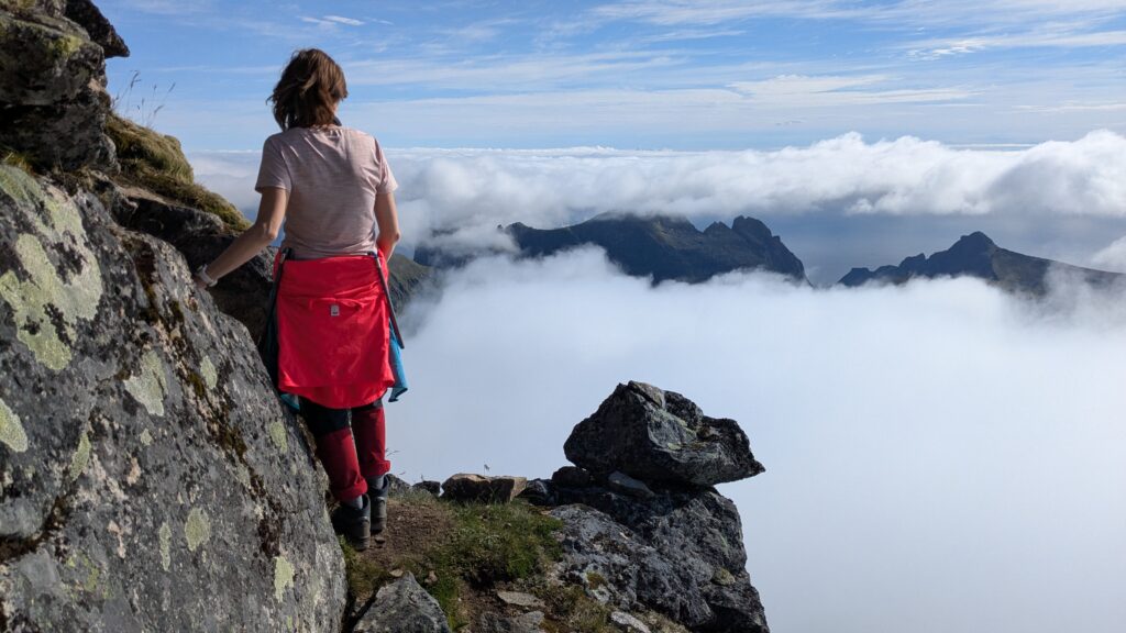
The peak was partially hidden in clouds, but the wind kept moving them.
One moment covered, the next completely clear.
We took one backpack: water, snacks, warm layers.
First down, then up.
The ridge was narrow, exposed.
Chains and ropes in some sections.
Then a plateau, larger than expected.


And then the final climb.
Steep rock. Technical moves.
At one point, we had to pull ourselves up onto a high rock from a narrow ledge, not easy.
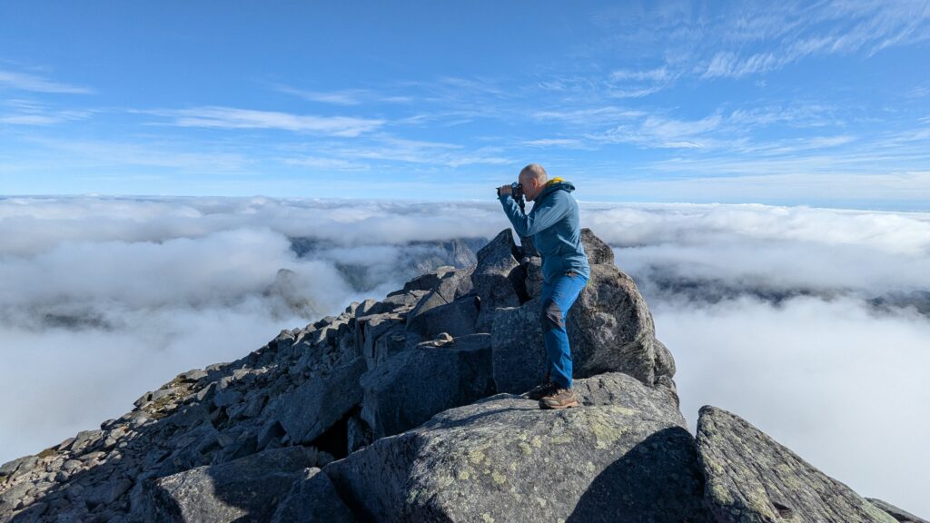
But the views… The best of the entire trip!
At the summit, just over 1,000 meters above sea level, we were above the clouds!
Completely above them.
It felt unreal.
The descent was easier than the climb, thankfully.
Back on the plateau, we packed our tents and made a decision:
we go all the way down.
No stop. Straight to the sea.
On the way, we paused once more, in a beautiful spot, at sunset, for a final meal.
And then we kept going.
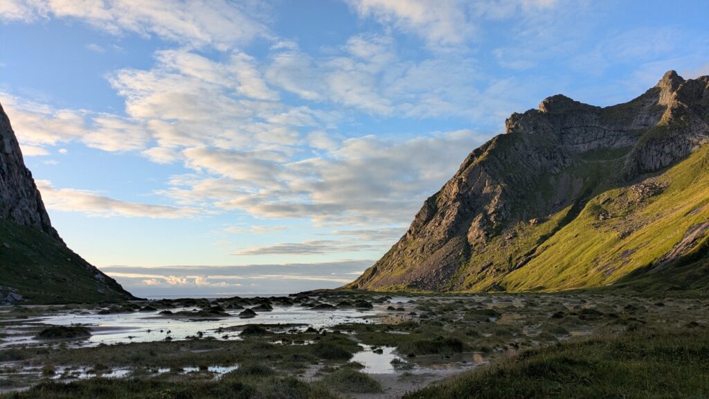
All the way down to Moskenes.
To the sea.
To the end.
The End
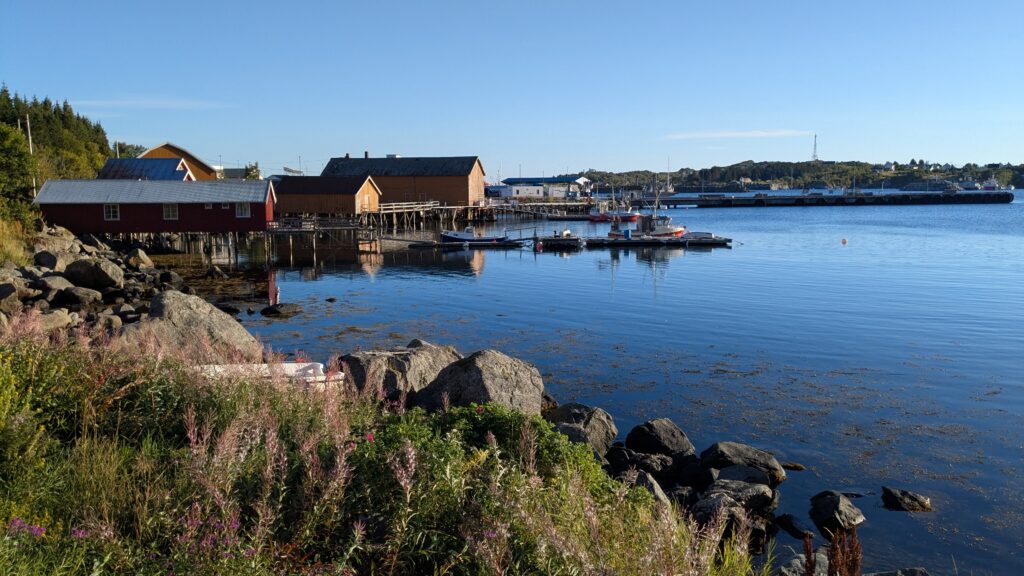
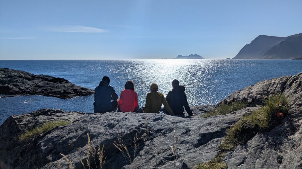
The next day we spent in Moskenes.
We visisited Å and passed very nice time there, just sitting at the seaside and relaxing.
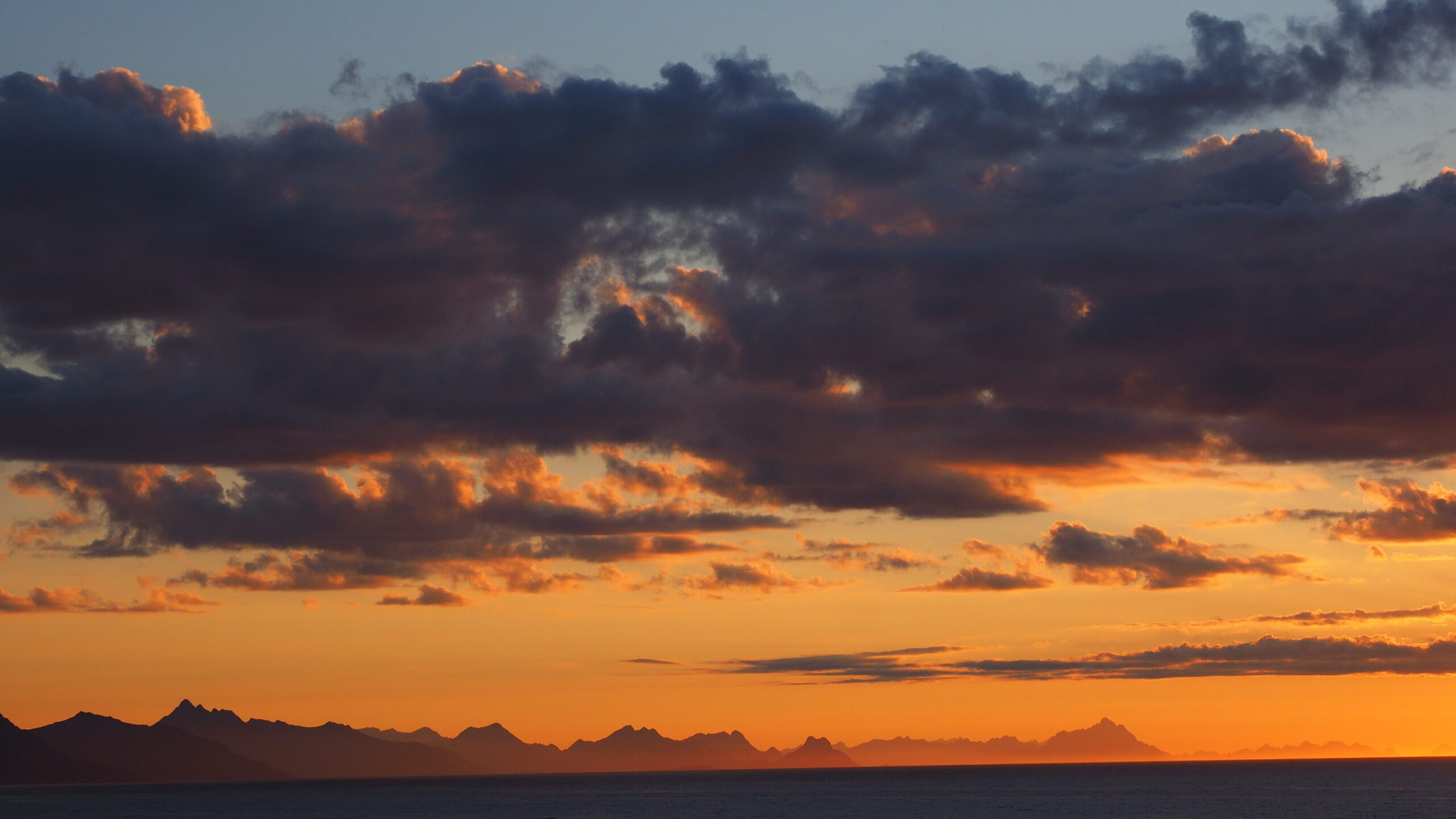
In the evening beautiful views on the Lofoten Wall.
Then went back by ferry to Bodo. Ferry free of charge for pedestrians.
We said goodbye to Lofoten.
With a feeling that it was tough but definitely worth!